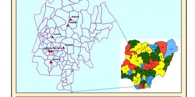
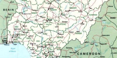
Explore the Map of Nigeria Showing Its 36 States and Capitals
The map of Nigeria displaying its 36 states is not just a geographical representation; it is a vital tool for understanding the country's political, cultural, and economic landscape. Each state in Nigeria has its own unique identity, with distinct languages, traditions, and resources. This map provides a clear visual representation of Nigeria’s diversity, showcasing the different regions, their capitals, and significant landmarks. Understanding the layout of Nigeria through this map is crucial for various purposes, including educational, tourism, and business planning.
Historically, Nigeria's states were created to foster better governance and social cohesion among its diverse ethnic groups. The current structure, which comprises 36 states and one Federal Capital Territory, Abuja, was established in 1996. Each state has its own government and legislative body, which plays a significant role in local administration. The map thus serves as a reminder of Nigeria's journey towards federalism, where states have been created not only for administrative purposes but also to ensure representation and resource allocation among its various ethnic groups.
Geographically, the map of Nigeria highlights the country's varied landscapes, from the coastal regions in the south to the arid areas in the north. Each state has its own geographical features, such as mountains, rivers, and plains. For instance, Lagos, located in the southwest, is known for its bustling urban environment and coastal beaches, while Kano, in the north, is renowned for its historical significance and trade. This geographic diversity contributes to the rich tapestry of Nigerian life, influencing everything from cuisine to economic activities. Additionally, the map helps in understanding the climatic variations across the states, which range from tropical in the south to semi-arid in the north.
The practical uses of the map of Nigeria showcasing its 36 states are extensive. It is an essential resource for students, educators, and researchers interested in Nigerian geography and demographics. Tourists can use the map to plan their travels, discover hidden gems, and appreciate the cultural diversity across states. For businesses, understanding the geographical layout and economic prospects of different states can aid in strategic planning and investment decisions. Furthermore, policymakers can utilize this map to identify regions that require development or support, ensuring that resources are allocated effectively to improve living standards across the nation.
In conclusion, the map of Nigeria showing its 36 states is more than just a visual representation; it is a gateway to understanding the complexities of this vibrant nation. Whether you are a student, traveler, or business professional, this map offers valuable insights into Nigeria's rich cultural heritage and geographical significance. Exploring the map not only enhances one's knowledge about the country but also fosters a deeper appreciation for its diverse peoples and places.
The map of Nigeria is an invaluable resource for anyone looking to understand the country's geography and cultural diversity. Delve into Nigeria's map and discover the fascinating stories behind its states and regions.
-
Nigeria is the most populous country in Africa, with over 200 million residents, making the delineation of its 36 states crucial for governance and resource distribution.
-
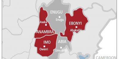
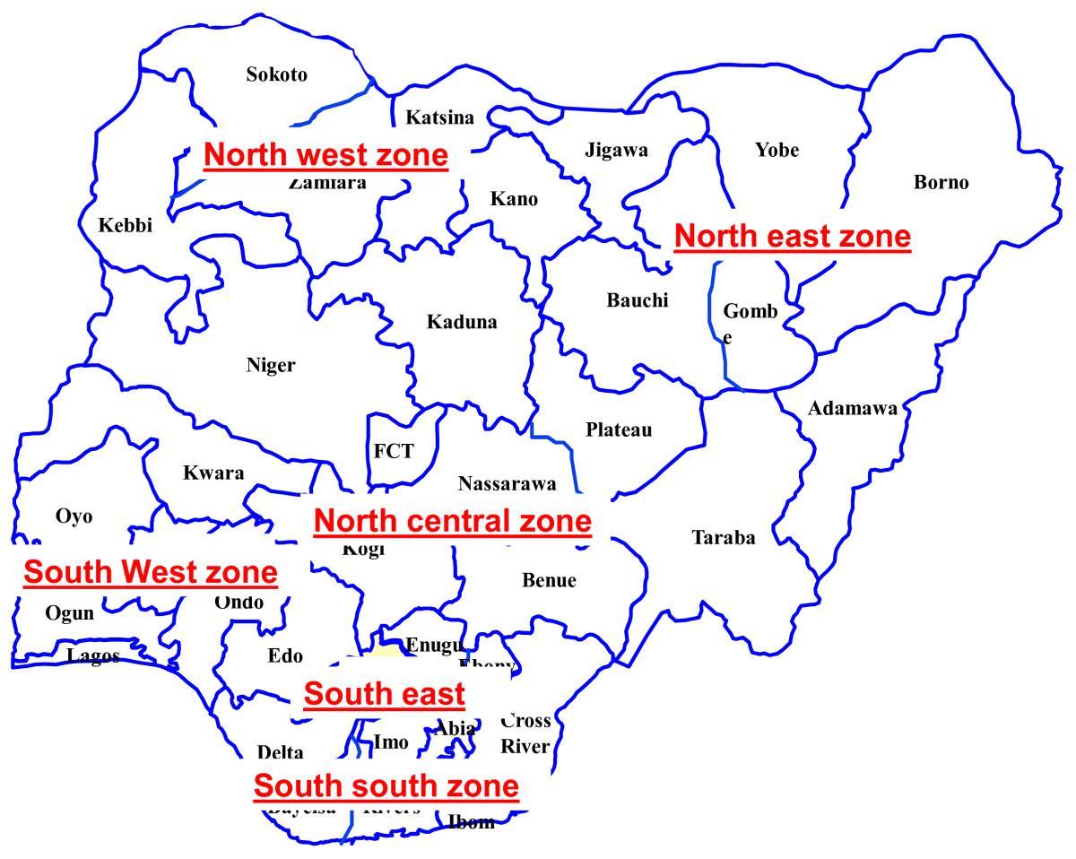
The states of Nigeria are divided into six geopolitical zones, which include North East, North West, North Central, South East, South West, and South South, each with distinct cultural and economic characteristics.
-
Lagos State is the most populous state in Nigeria, with a population of over 21 million, significantly influencing the country's economy as a commercial hub.
-
Kano State, known for its historical significance, is home to the ancient city of Kano, which was a major center of trade and culture in medieval West Africa.
-
Rivers State, located in the Niger Delta, is rich in oil and gas resources, making it vital to Nigeria's economy and energy sector.
-
Benue State is often referred to as the 'Food Basket of Nigeria' due to its agricultural productivity, particularly in crops like yams and cassava.
-
The Federal Capital Territory, where Abuja is located, was created in 1976 to serve as the political and administrative center of Nigeria, replacing Lagos as the capital.
-
Enugu State is recognized for its coal deposits and was historically a significant mining region, impacting Nigeria's industrial development.
-
Cross River State is famous for its biodiversity, housing the Cross River National Park, which is a UNESCO World Heritage Site and a haven for various endangered species.
-
Ogun State is known for its rich cultural heritage, with a number of festivals celebrating the Yoruba culture, including the popular Lisabi Festival.