Explore Stunning Pictures of Nigerian Maps: Geography & History
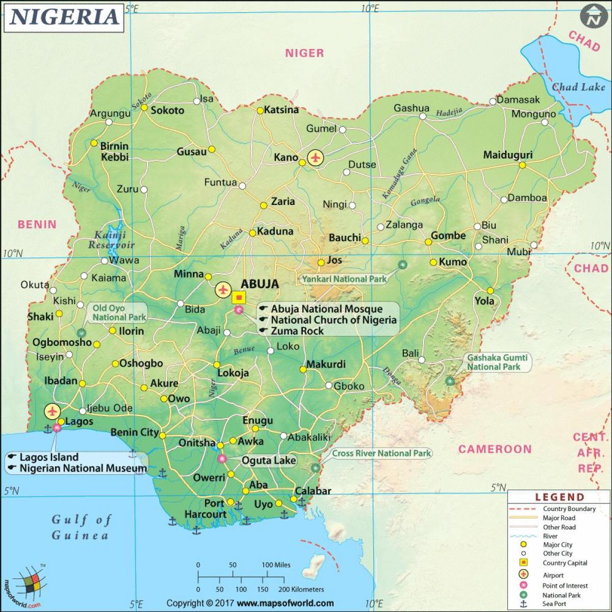
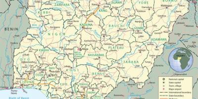
Nigeria, located in West Africa, is a country rich in culture, history, and geographical diversity. Pictures of the Nigerian map reveal not just the physical landscape, but also the intricate borders that define its 36 states and the Federal Capital Territory, Abuja. These maps illustrate Nigeria's unique positioning on the African continent, bounded by the Atlantic Ocean to the south, and neighboring countries such as Benin, Niger, Chad, and Cameroon. The visuals provide a clear understanding of how Nigeria is situated within its regional context, which is essential for both educational and practical purposes.
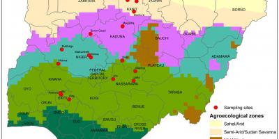
Understanding the layout of Nigeria through its maps is crucial for various reasons. Firstly, geographic maps serve as a vital tool for navigation, allowing travelers and locals to explore its vast terrains, from the coastal areas of Lagos to the mountainous regions of the northeast. Moreover, maps highlight significant rivers, such as the Niger and Benue Rivers, which are essential for trade, transportation, and agriculture. Pictures of these maps also help in visualizing the climatic zones of Nigeria, ranging from the arid north to the humid south, which in turn influences the country’s agricultural practices and lifestyle.
Historically, maps have played a significant role in shaping Nigeria's identity. The borders depicted in modern maps were largely drawn during the colonial era, a period that significantly influenced Nigeria's ethnic composition and socio-political landscape. Pictures of Nigerian maps from different eras can illustrate the evolution of these boundaries, reflecting the historical context of colonial rule and the subsequent struggle for independence. This historical perspective is vital for understanding contemporary issues related to regionalism and ethnic tensions within the country.
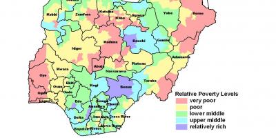
Geographically, Nigeria is blessed with rich resources, and maps help identify areas abundant in oil, minerals, and agricultural land. The Niger Delta, for instance, is depicted in many maps as a crucial region for oil production, which is the backbone of Nigeria's economy. By studying these maps, one can understand the geographic distribution of these resources and the socioeconomic implications they have on the country's development. Furthermore, maps showing population density can indicate urbanization trends, helping planners design better infrastructure and public services to meet the needs of growing cities.
In practical terms, pictures of Nigerian maps are indispensable for researchers, students, and professionals alike. They are used in various fields from environmental studies to urban planning, providing a foundational understanding of Nigeria's diverse landscapes and demographics. Additionally, maps are often utilized in educational settings to teach geography, history, and social studies, making them valuable resources for learning about Nigeria’s complexity and richness.
In conclusion, pictures of the Nigerian map serve multiple purposes, from illustrating the country's geographic layout to providing historical insights and practical applications. Understanding these maps not only enhances knowledge about Nigeria's geography but also fosters a deeper appreciation for its diverse cultures and landscapes. Exploring these maps can ignite curiosity and encourage further study into the vibrant tapestry that is Nigeria.
The exploration of Nigerian maps offers valuable insights into the nation's geography and history. By delving into these pictures, you can gain a deeper understanding of Nigeria's rich cultural heritage and landscape.
-
Nigeria is the most populous country in Africa, with over 200 million inhabitants as of 2021, making it a significant demographic force on the continent.
-
The Niger River, one of the longest rivers in Africa, runs through Nigeria and is vital for both transportation and irrigation in the region.
-
Nigeria has over 250 ethnic groups, with the three largest being the Hausa, Yoruba, and Igbo, reflecting a rich cultural diversity seen in its maps.
-
The Federal Capital Territory, where Abuja is located, was created in 1976 to centralize governance and is depicted in maps as a separate area within Nigeria.
-
Nigeria's coastline stretches over 800 kilometers along the Atlantic Ocean, which is represented in coastal maps showing major ports such as Lagos and Port Harcourt.
-
The Nigerian map showcases a variety of geographical features, including savannas, forests, and mountains, highlighting the country's ecological diversity.
-
Maps of Nigeria illustrate its many natural resources, particularly oil, which accounts for a significant portion of the country's GDP and is mainly extracted from the Niger Delta region.
-
Nigeria is home to the Olumo Rock, a significant tourist attraction, depicted on many local maps, located in Abeokuta, Ogun State.
-
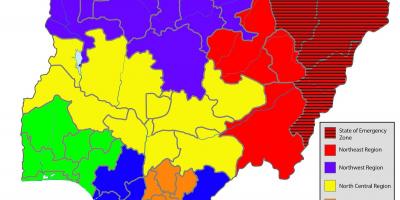
The country is divided into six geopolitical zones, which are often highlighted in various maps to facilitate governance and development planning.
-
Nigeria's historical maps reveal the impact of colonialism, showing how borders were drawn without regard for ethnic and cultural divisions, leading to modern-day challenges.