Explore the Topographic Map of Nigeria: Geography and Features
The topographic map of Nigeria is an invaluable resource that visually represents the country's diverse geographical features, including its mountains, valleys, plateaus, and rivers. This type of map provides detailed information on elevation changes, landforms, and the distribution of various ecosystems across Nigeria. Understanding the topography of Nigeria is essential for numerous reasons, including environmental planning, resource management, and educational purposes. It helps illustrate how the country's natural landscape influences its climate, agriculture, and settlement patterns.
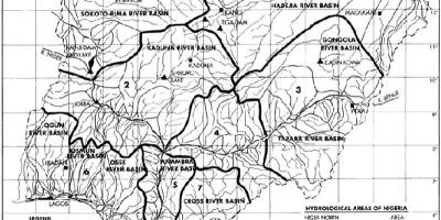
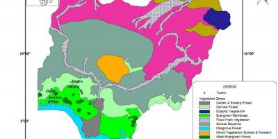
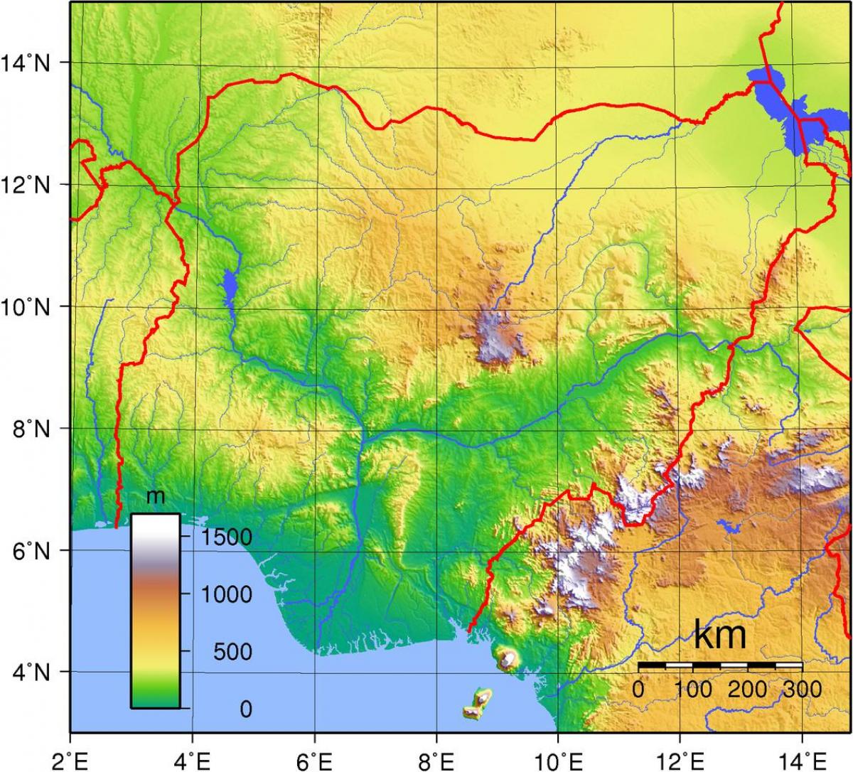
Nigeria is characterized by its varied topography, which includes the prominent Jos Plateau in the central region, with its high elevation providing a cooler climate compared to the surrounding areas. In contrast, the coastal regions along the Atlantic Ocean are predominantly flat, featuring low-lying areas that are susceptible to flooding. The Niger and Benue Rivers, two major waterways in Nigeria, also shape the topography significantly, creating fertile plains that support agriculture and trade. The topographic map allows users to see the intricate relationship between these waterways and the surrounding terrain, which is crucial for understanding the country's agriculture and transportation networks.
Historically, the topographic features of Nigeria have influenced human settlement and cultural development. For instance, the rugged terrain of the North has historically been less accessible, leading to distinct cultural practices and lifestyles compared to the more urbanized and accessible Southern regions. The topography has played a key role in the historical movements of people, trade routes, and even conflicts. By studying the topographic map, one can gain insights into how these geographical features have shaped the history and development of various Nigerian ethnic groups and their interactions.
Geographically, Nigeria's topography is significant for environmental studies and conservation efforts. Understanding the elevations and landforms helps researchers identify regions that are more vulnerable to climate change and environmental degradation. This information is vital for developing effective conservation strategies and for ensuring the sustainable use of natural resources. The topographic map serves as a tool for environmentalists, urban planners, and policymakers who need to consider geographical features when making decisions that affect the ecosystem and communities.
In practical terms, the topographic map of Nigeria is used in various fields, including tourism, agriculture, and infrastructure development. Tourists use these maps to explore Nigeria's national parks and natural attractions, while farmers rely on the information to select appropriate crops based on the terrain. Additionally, urban planners utilize the topographic details to design roads, buildings, and other infrastructures that harmonize with the natural landscape. The map is not just a representation of physical features; it is a critical tool that aids in decision-making and planning across multiple sectors.
In conclusion, the topographic map of Nigeria is more than just a visual representation of the land; it encapsulates the essence of the country's geography, history, and cultural heritage. By exploring this map, one can appreciate the complexity and beauty of Nigeria's landscapes while understanding the practical implications of its topography. For anyone interested in Nigerian geography or planning to visit, this map is an essential resource that opens up a world of exploration and knowledge.
Understanding the topographic map of Nigeria enriches your appreciation of the country's diverse landscapes and their significance. Dive deeper into Nigerian geography to uncover more fascinating insights and stories.
-
Nigeria is home to the Jos Plateau, which is the highest point in the country, reaching elevations of about 1,200 meters above sea level.
-
The Niger River is the longest river in Nigeria, stretching over 4,180 kilometers, and it plays a crucial role in transportation and agriculture.
-
Nigeria's coastal region is characterized by a vast expanse of mangrove forests, which are vital for biodiversity and serve as a buffer against coastal erosion.
-
The country's topography includes over 250 ethnic groups, each adapting to and utilizing its unique geographical features for their livelihoods.
-
Lake Chad, located in the northeastern part of Nigeria, is one of the largest lakes in Africa, though it has significantly shrunk due to climate change and water diversion.
-
The Western Highlands of Nigeria are known for their rich mineral deposits, including tin and columbite, which have historically contributed to the region's economy.
-
Nigeria has a tropical climate, but its topography creates distinct climate zones, ranging from arid in the north to humid in the south.
-
The country's highest peak, Chappal Waddi, is located in the Adamawa region and stands at approximately 2,419 meters above sea level.
-
The Niger Delta is one of the world's largest deltas and is rich in oil reserves, making it a critical area for Nigeria's economy and environmental concerns.
-
Topographic maps are essential for disaster management in Nigeria, helping to assess flood risks in low-lying areas and the impact of landslides in hilly regions.