Explore the Detailed Vector Map of Nigeria for Geography Enthusiasts
The vector map of Nigeria serves as a crucial tool for understanding the country's geography. This digital representation provides a clear and scalable view of Nigeria's diverse landscapes, cities, and regions. Unlike raster images, vector maps are resolution-independent; they can be scaled to any size without losing quality, making them ideal for various applications such as educational purposes, urban planning, and tourism. Understanding Nigeria's geography through this vector map allows users to grasp the country's vast and varied topography, from its coastal areas along the Atlantic Ocean to the rugged terrains in the north.
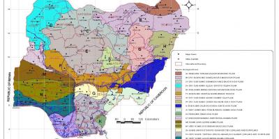
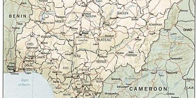
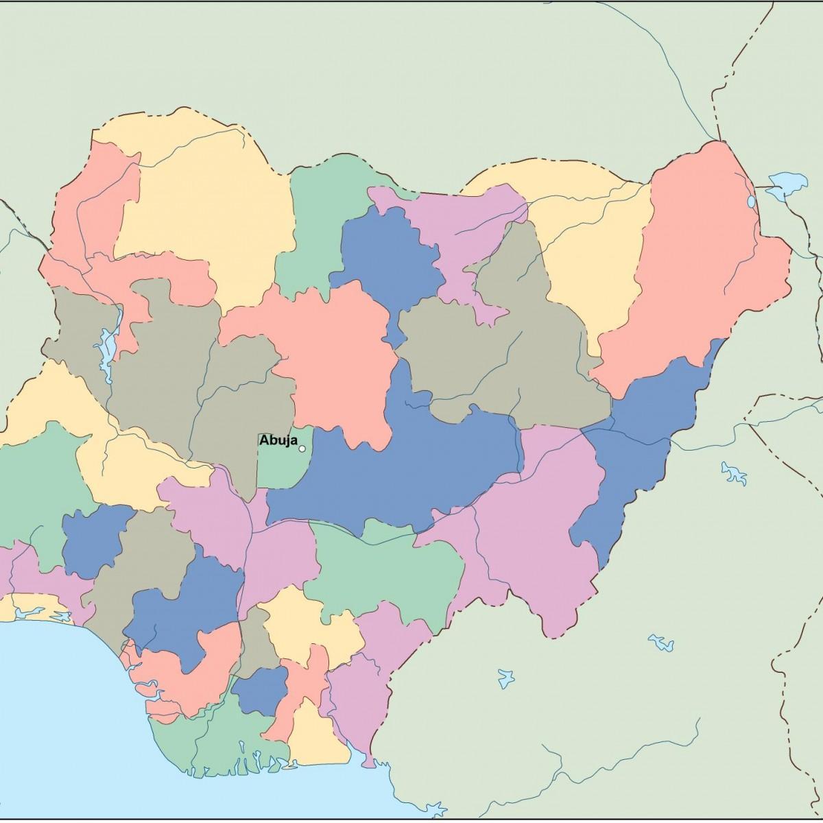
One of the key features of the Nigeria vector map is the detailed depiction of its 36 states and the Federal Capital Territory, Abuja. Each state is represented with distinct boundaries, allowing for easy identification and analysis. This is particularly important for students, educators, and researchers who require accurate geographical data for studies or projects. Additionally, the map highlights significant cities such as Lagos, Kano, and Port Harcourt, which are pivotal for Nigeria's economic activities. The vector map also marks major rivers, roads, and transportation networks, providing users with a comprehensive understanding of how these elements interconnect within the nation's landscape.
Historically, maps have played a vital role in shaping our understanding of territories and nations. The vector map of Nigeria not only reflects the current political boundaries but also hints at the historical dynamics that have influenced these borders. The colonial legacy, ethnic diversity, and historical migrations have all contributed to the present-day configuration of Nigeria’s states. This historical context enriches the significance of the vector map, as it serves as a reminder of Nigeria’s complex past and the ongoing evolution of its geographic identity.
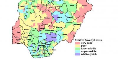
Geographically, Nigeria is unique due to its diverse climate zones that range from tropical in the south to arid in the north. This diversity is essential for understanding agricultural practices, wildlife habitats, and the socio-economic activities of different regions. The vector map allows users to visualize this climatic variation, facilitating better planning for agriculture, infrastructure development, and environmental conservation. By analyzing the map, one can also explore how Nigeria's geography impacts its cultural diversity, with over 250 ethnic groups contributing to a rich tapestry of languages, traditions, and lifestyles.
In practical terms, the Nigeria vector map is an invaluable resource for businesses and policymakers. It aids in strategic planning, resource allocation, and development projects. Companies looking to invest in Nigeria can benefit from understanding the geographical nuances that affect market access and logistics. Moreover, the map is beneficial for travelers and adventurers, providing insights into the geographic layout of attractions and natural wonders. By utilizing the vector map, one can make informed decisions about travel routes and destinations within Nigeria.
In conclusion, the vector map of Nigeria is not just a visual representation of the country; it is a comprehensive tool that encapsulates the geographical, historical, and cultural significance of Nigeria. Whether for academic research, business strategy, or personal exploration, this map serves as a gateway to understanding the complexities of Nigeria's landscapes and societies. Exploring Nigeria through its vector map opens up opportunities for learning and appreciation of this vibrant nation.
The vector map of Nigeria offers invaluable insights into its geography and history. We encourage you to delve deeper into the rich landscapes and cultures that shape Nigeria.
-
Nigeria is the most populous country in Africa, with over 200 million residents.
-
Lagos is one of the fastest-growing cities in the world and serves as Nigeria's commercial hub.
-
The Niger River, the longest river in Nigeria, spans over 4,180 kilometers.
-
Nigeria has over 250 ethnic groups, with the Hausa, Yoruba, and Igbo being the largest.
-
The country is rich in natural resources, including oil, natural gas, and minerals.
-
Nigeria's geography includes diverse landscapes, from coastal plains to plateaus and mountains.
-
The Federal Capital Territory, Abuja, was created in 1976 to promote national unity and development.
-
Nigeria is home to several national parks, including Yankari National Park, known for its hot springs and wildlife.
-
The country is a major producer of agricultural products, including yams, cassava, and cocoa.
-
Nigeria's climate ranges from tropical in the south to arid in the north, influencing its diverse ecosystems.