Explore the Map of Nigeria Featuring the River Niger and Benue
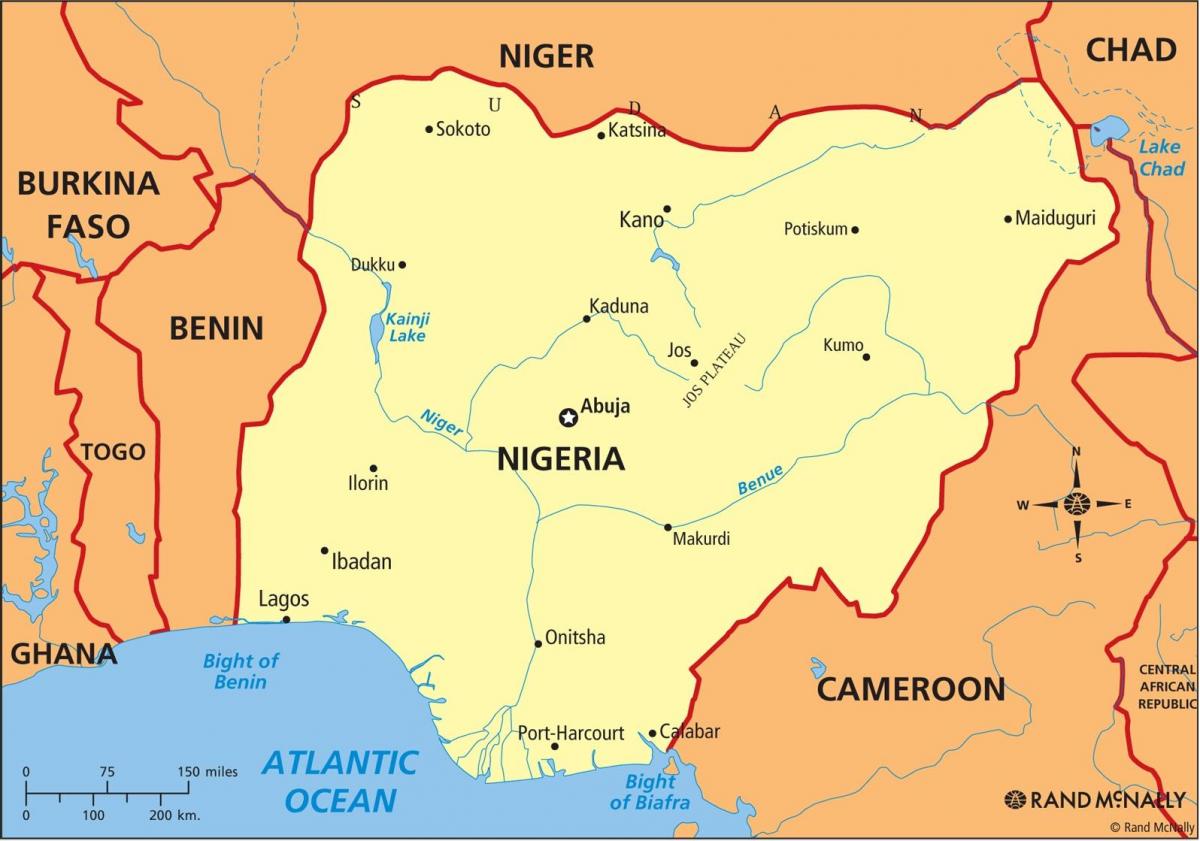
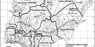
The map of Nigeria showcasing the River Niger and Benue is a vital tool for understanding the country's geography and hydrology. These two major rivers are not only essential for the ecosystem but also play a crucial role in the livelihoods of many Nigerians. The River Niger is the longest river in West Africa, flowing over 4,180 kilometers, while the Benue River, a significant tributary of the Niger, stretches roughly 1,400 kilometers. Together, they form a unique confluence that is vital for transportation, agriculture, and fishing in the region.
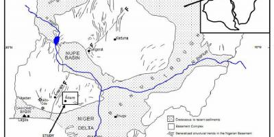
Geographically, the River Niger runs from the northwestern part of Nigeria and meanders down to the southern coast, where it empties into the Atlantic Ocean. The Benue River flows from the east and joins the Niger at Lokoja, Kogi State. This confluence is not just a geographical landmark; it has historical significance as well. Historically, these rivers have served as routes for trade and cultural exchange among various ethnic groups in Nigeria, facilitating the movement of goods and people long before the advent of modern transportation.
The significance of the River Niger and Benue extends beyond historical context; they are integral to Nigeria's economy today. The waterways support fishing industries and provide irrigation for agriculture, which is a key sector in Nigeria. The fertile plains along these rivers are home to various crops, including rice, yams, and cassava. Additionally, the rivers offer transportation routes for goods, linking rural communities to urban markets, thus enhancing trade opportunities.
From an ecological standpoint, the areas surrounding the River Niger and Benue are rich in biodiversity. These rivers support numerous species of fish and wildlife, making them essential for conservation efforts. The wetlands formed by their banks are habitats for various bird species, some of which are migratory. Understanding the ecological importance of this region is crucial for sustainable development and environmental management in Nigeria.
In practical terms, maps depicting the River Niger and Benue are valuable resources for researchers, students, and travelers alike. They offer insights into the geography of Nigeria and highlight the potential for adventure tourism in the country, such as boat tours and fishing expeditions. Furthermore, these maps are essential for urban planners and policymakers who aim to manage resources effectively and develop infrastructure around these vital waterways.
In conclusion, the map of Nigeria featuring the River Niger and Benue provides a comprehensive look at the geographical, historical, and ecological significance of these waterways. Their importance cannot be overstated, as they continue to shape the lives of millions of Nigerians. Exploring this map opens up a world of understanding about Nigeria's natural landscape and its impact on society.
In summary, the map highlighting the River Niger and Benue is an essential resource for anyone interested in Nigerian geography. It showcases the intricate relationship between these rivers and the cultural heritage of Nigeria, inviting further exploration into this vibrant nation's landscape.
-
The River Niger is the third longest river in Africa, following the Nile and the Congo.
-
The Niger River basin covers about 1.5 million square kilometers across several West African countries.
-
Lokoja, where the Niger and Benue rivers meet, was the first capital of Nigeria during British colonial rule.
-
The name 'Niger' is derived from the Latin word 'niger', meaning 'black', referring to the dark waters of the river.
-
The Benue River is known for its rich fishing grounds, particularly for species like catfish and tilapia.
-
Over 90% of Nigeria's inland waterways are found in the Niger River system, making it crucial for transport.
-
The Niger River has several man-made dams, including the Kainji Dam, which generates hydroelectric power.
-
The rivers are significant for their cultural importance, with many tribes along their banks celebrating annual festivals related to their waters.
-
The Niger River delta is one of the world's largest and most biodiverse ecosystems, home to numerous endangered species.
-
The economic activities along the Niger and Benue rivers contribute significantly to the GDP of Nigeria, particularly in agriculture and fishing.