Explore the Detailed Map of Nigeria: Geography and Significance
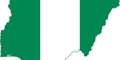
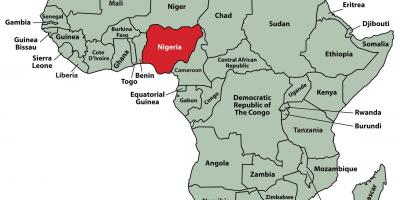
Nigeria, located in West Africa, is the most populous country on the continent, boasting a rich tapestry of cultures, languages, and landscapes. A detailed map of Nigeria provides crucial insights into its geographic diversity, from the coastal plains along the Atlantic Ocean to the rugged terrain of the Jos Plateau. This map is not just a representation of physical boundaries; it encapsulates the complex interplay of Nigeria’s ethnic groups, economic zones, and natural resources, making it an essential tool for understanding the country’s dynamics.
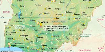
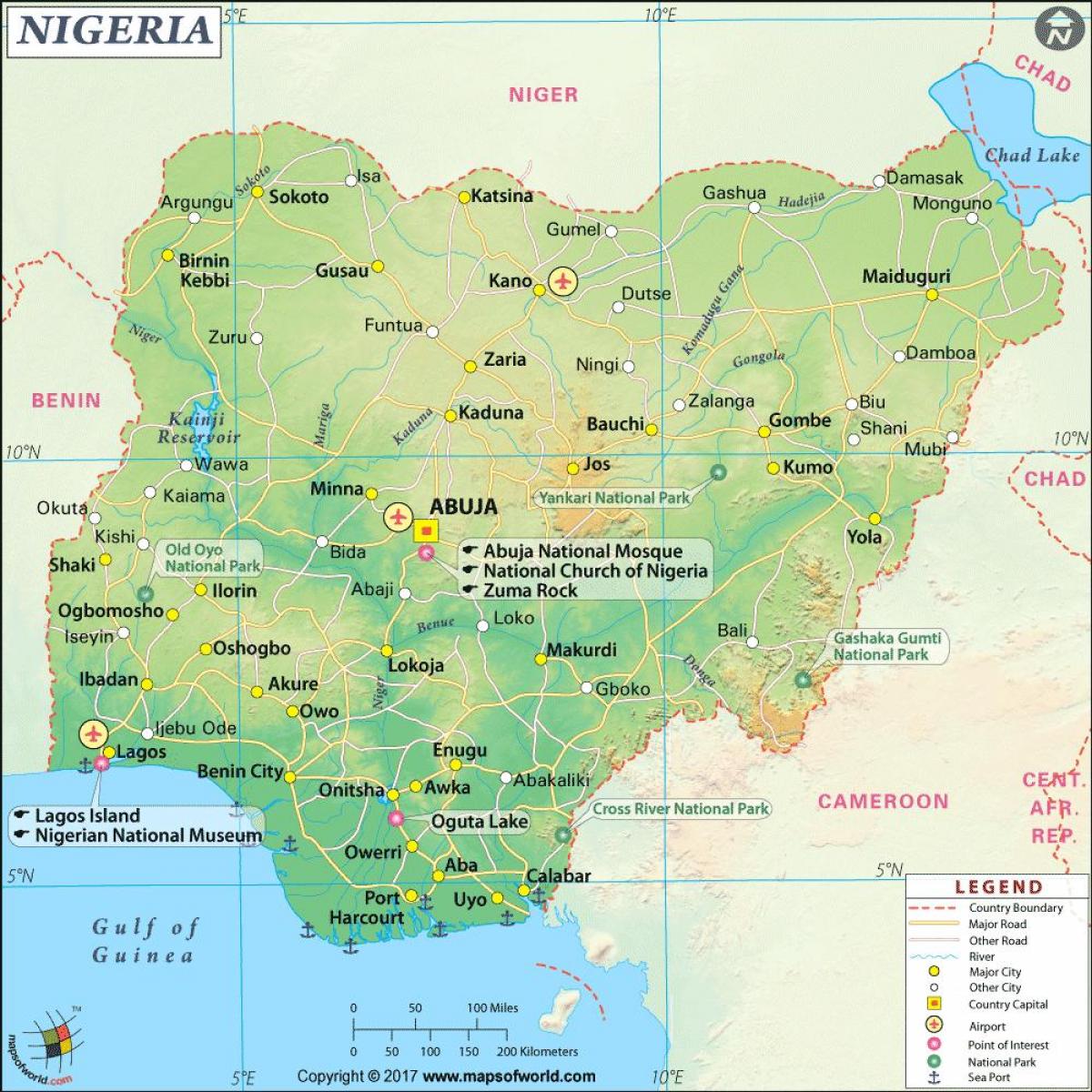
The significance of the map of Nigeria extends beyond mere navigation. For instance, it highlights key cities such as Lagos, the bustling economic hub, and Abuja, the capital city known for its planned architecture and political importance. Each region, whether it be the Hausa-Fulani areas in the north or the Yoruba and Igbo regions in the south, has its unique characteristics that are vividly depicted on the map. This geographical representation helps in appreciating the socio-cultural diversity that is a hallmark of Nigerian society.
Historically, maps of Nigeria have played a critical role in the country’s development. During the colonial era, these maps were essential for administrative purposes and resource allocation. Today, they are invaluable for researchers, students, and anyone interested in Nigeria’s history and geography. Understanding the layout of Nigeria through its map allows for a deeper appreciation of how historical events have shaped its present, including the impact of colonialism, the civil war, and ongoing economic challenges.
Geographically, Nigeria is blessed with a variety of climates and ecosystems. From the mangrove swamps in the Niger Delta to the arid regions of the north, the map provides a visual representation of these diverse environments. It also serves practical uses for ecological studies, urban planning, and disaster management. Researchers can utilize the map to identify areas prone to flooding or drought, which is crucial for developing strategies to mitigate these challenges.
Moreover, the map of Nigeria serves as a vital resource for travelers. It outlines major roads, national parks, and tourist attractions, making it easier for visitors to navigate the country. Popular destinations like the Olumo Rock in Abeokuta or the natural wonders of the Yankari National Park are prominently featured, helping tourists plan their journeys effectively. Whether for adventure seekers or cultural enthusiasts, the map enhances the travel experience by providing a clear understanding of geographic locations.
In conclusion, the map of Nigeria is more than just a visual representation; it is a gateway to understanding the country's complex geography and rich cultural heritage. It aids in historical context, practical navigation, and ecological studies, making it an invaluable asset for anyone interested in Nigeria. Exploring this map opens up a world of knowledge about one of Africa's most significant nations, encouraging further exploration of its diverse landscapes and cultures.
In summary, the map of Nigeria offers a comprehensive view of its geography and cultural diversity. Whether you are a researcher, traveler, or enthusiast, delving into this map will enhance your understanding of Nigeria's unique characteristics.
-
Nigeria is home to over 250 ethnic groups, making it one of the most culturally diverse countries in the world.
-
The Niger River, one of the longest rivers in Africa, flows through Nigeria and is a vital source of water and transportation.
-
Lagos is the largest city in Nigeria and is considered one of the fastest-growing cities globally, with a population exceeding 14 million.
-
Nigeria has the largest economy in Africa, driven largely by its oil and gas sector, which is prominently marked on economic maps.
-
The country has three major regions: the North, the West, and the East, each with distinct languages and traditions.
-
Nigeria's climate varies from arid in the north to tropical in the south, influencing agriculture and settlement patterns.
-
The Jos Plateau, located in central Nigeria, is known for its unique geography and cooler climate, making it a popular tourist destination.
-
Nigeria is a member of the Economic Community of West African States (ECOWAS), which is significant for regional trade and cooperation.
-
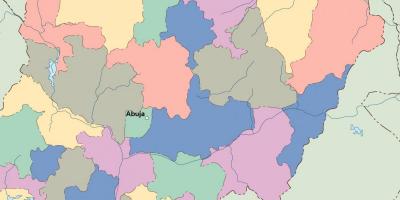
The country has 36 states and one Federal Capital Territory (Abuja), which are all distinctively represented on its maps.
-
Nigeria's biodiversity includes many endemic species, particularly in its rainforests, which are crucial for ecological studies.