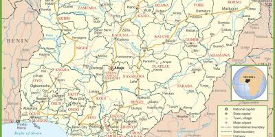
Explore the Map of Nigeria: Relief and Drainage Explained
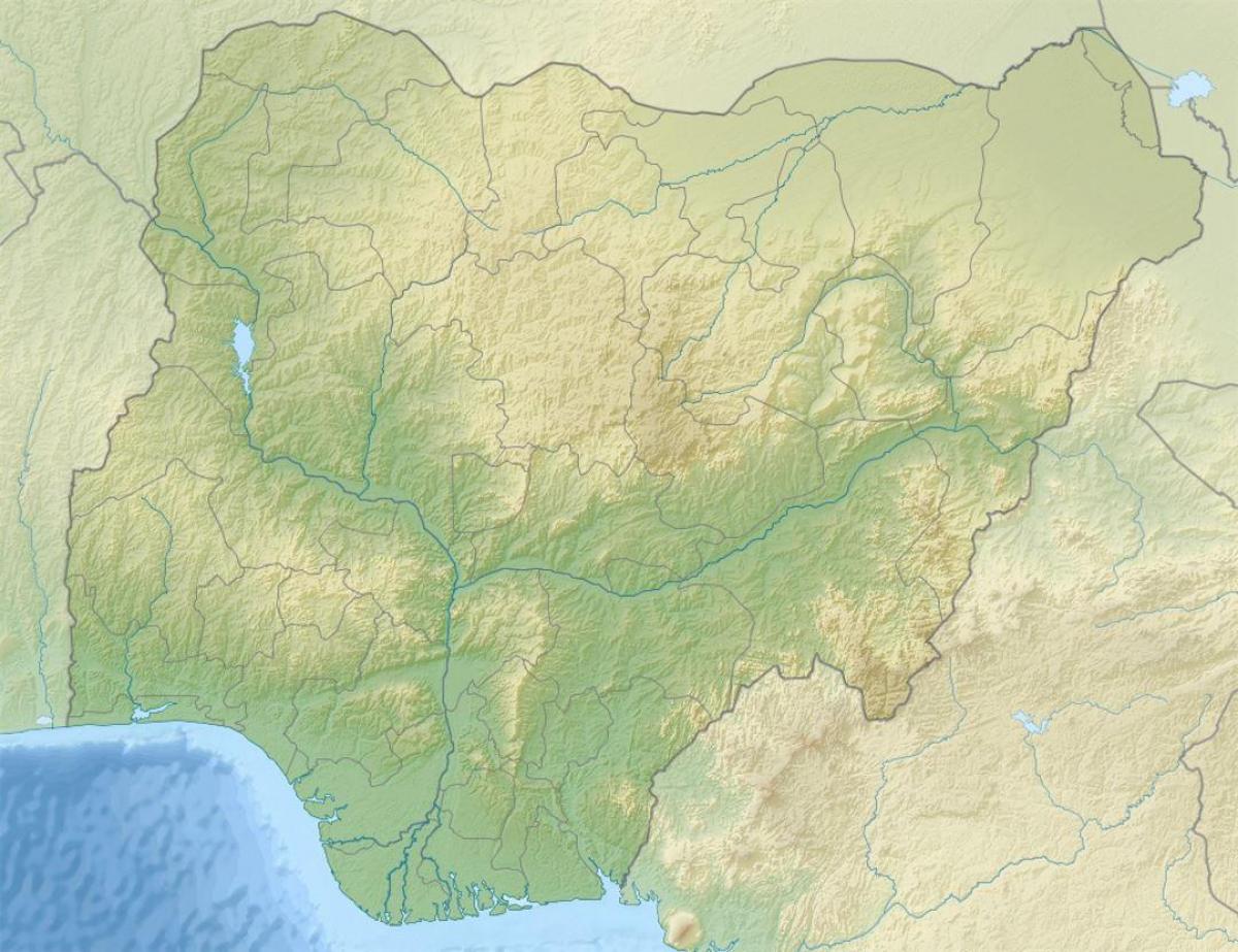
The map of Nigeria showing relief and drainage is an essential tool for understanding the country's complex geographic features. This map illustrates the varying elevations across Nigeria, highlighting mountain ranges, plateaus, and plains. Additionally, it details the drainage systems, including rivers, lakes, and wetlands. Understanding these physical features is critical for numerous reasons, including environmental management, urban planning, and agricultural development.
Nigeria's geography is incredibly diverse, featuring the Jos Plateau, which rises to about 1,200 meters above sea level, and the coastal plains that line the Atlantic Ocean. The Niger and Benue Rivers serve as the two major drainage systems in Nigeria. These rivers are not only vital for irrigation and transportation but also play a significant role in the country's cultural and economic activities. The map provides a clear visual representation of how these rivers intersect and contribute to the overall hydrology of Nigeria.
Historically, the relief and drainage of Nigeria have shaped human settlement patterns. Regions with fertile land and accessible water sources attracted the earliest inhabitants, leading to the establishment of major cities such as Lagos and Kano. The map of Nigeria showing relief and drainage also highlights areas prone to flooding, which has implications for disaster risk management and urban planning. Understanding these historical contexts enhances our appreciation of how geography influences societal development.
Furthermore, the geographical significance of this map extends beyond merely identifying landforms and water bodies. It allows for better environmental conservation efforts. For instance, areas of high biodiversity, such as the Niger Delta region, can be prioritized for protection based on their unique relief features and drainage patterns. This knowledge is crucial for policymakers and environmentalists aiming to preserve Nigeria's rich ecosystems.
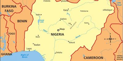
In practical terms, this map serves various audiences, including educators, researchers, and students. For educators, it can be a valuable teaching resource in geography classes, helping students visualize Nigeria's physical landscape. Researchers often utilize such maps for environmental studies, resource management, and urban planning. For tourists, understanding the geographical features can enhance their travel experiences, allowing them to appreciate the natural beauty of Nigeria's landscapes.
In conclusion, the map of Nigeria showing relief and drainage is a vital resource for anyone interested in the country's geography. It offers insights into the physical features that shape Nigeria's environment, economy, and culture. By exploring this map, individuals can gain a deeper understanding of Nigeria's diverse landscapes and their implications for human activities.
The map of Nigeria showing relief and drainage is not just a visual representation; it is a gateway to understanding the country's intricate geography. Explore further to appreciate Nigeria's natural wonders and their significance.
-
Nigeria is home to the highest point in West Africa, the Chappal Waddi, which stands at 2,419 meters.
-
The Niger River is the third-longest river in Africa, spanning about 4,180 kilometers.
-
The Benue River, Nigeria's second major river, is approximately 1,400 kilometers long and is a significant tributary of the Niger River.
-
The Jos Plateau, a major landform in Nigeria, is famous for its tin deposits and unique fauna and flora.
-
Lake Chad, located in the northeastern part of Nigeria, is one of the largest lakes in Africa, although it has shrunk considerably over the years due to climate change.
-
Nigeria has over 3,000 rivers, with the Niger and Benue being the most prominent and important for agriculture and transportation.
-
The country experiences diverse climatic zones, from the tropical climate in the south to the arid climate in the north, impacting its drainage systems.
-
The Niger Delta, a region characterized by its intricate network of rivers and swamps, is one of the richest biodiversity areas in Nigeria.
-
Nigeria's coastline along the Atlantic Ocean stretches over 850 kilometers, featuring various ecosystems, including mangroves and sandy beaches.
-
The country's varied relief and drainage patterns play a crucial role in its agriculture, influencing crop distribution and farming practices.