Explore the Map of Eastern Nigeria: Geography and Insights
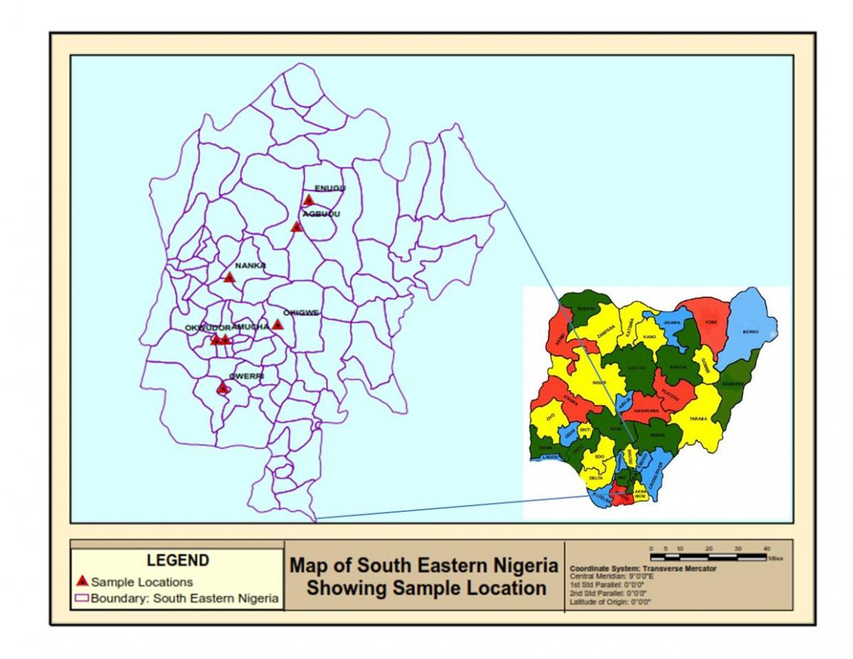
Eastern Nigeria is a vibrant region known for its rich culture, diverse landscapes, and significant historical context. A detailed map of Eastern Nigeria provides essential information about its cities, rivers, and geographical features, making it a valuable resource for locals and visitors. This area encompasses several states including Enugu, Ebonyi, Abia, Imo, and Anambra, each with unique attributes that contribute to the region's identity. The map illustrates the topographical variations, from the rolling hills of Enugu to the lush river valleys that characterize parts of Ebonyi State.
Understanding the geography of Eastern Nigeria is crucial not only for navigation but also for appreciating the ecological diversity of the area. The region is home to the Niger River, which plays a vital role in agriculture and fishing, supporting the livelihoods of many communities. The climate is predominantly tropical, characterized by a wet and dry season; this climate is instrumental in shaping the agricultural practices seen throughout the region. The map of Eastern Nigeria highlights these geographical features, showcasing how land use and settlement patterns have evolved over time.
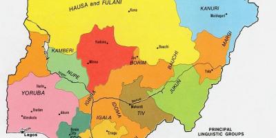
Historically, Eastern Nigeria has been a significant area due to its involvement in the Nigerian Civil War and its role in the Biafran secession. A historical map can provide insights into the territorial changes that have occurred since the pre-colonial era. The cultural significance of the region is also evident in its numerous festivals, traditional practices, and the rich heritage of the Igbo people. By analyzing the map, one can appreciate how historical events have influenced the current layout of towns and cities, as well as the economic development of the region.
For travelers, the map of Eastern Nigeria serves practical purposes. It aids in planning routes to popular tourist destinations like the Ogbunike Caves, Awhum Waterfall, and the vibrant markets of Onitsha. Each of these locations is marked on the map, allowing visitors to navigate with ease. Additionally, understanding the local road networks is crucial for transportation, as some areas may have limited access during the rainy season. Whether you are embarking on a road trip or conducting research, the map is an indispensable tool for exploring Eastern Nigeria.
In conclusion, the map of Eastern Nigeria is not just a representation of physical space; it is a gateway to understanding the region's geography, history, and culture. By utilizing this map, you can gain valuable insights into the dynamics of Eastern Nigeria and appreciate its multifaceted identity. From its lush landscapes to its rich cultural heritage, Eastern Nigeria has much to offer, and a well-detailed map is the first step toward discovering its treasures.
In summary, the map of Eastern Nigeria provides essential insights into the geography and culture of this dynamic region. We encourage you to explore further and discover the wonders that Eastern Nigeria has to offer.
-
Eastern Nigeria is home to the Igbo people, one of the largest ethnic groups in Nigeria, known for their rich cultural heritage and entrepreneurial spirit.
-
The Niger River, one of the longest rivers in Africa, flows through Eastern Nigeria, providing essential resources for agriculture and transportation.
-
Enugu State, often referred to as the 'Coal City State', was the center of coal mining in Nigeria, significantly contributing to the country's economy in the past.
-
The region experiences a tropical climate, with heavy rainfall typically occurring from April to October, impacting agricultural activities positively.
-
The city of Owerri, located in Imo State, is known for its bustling nightlife and is often considered the entertainment hub of Eastern Nigeria.
-
The famous Awhum Waterfall in Enugu State is a popular tourist destination, attracting visitors with its scenic beauty and serene environment.
-
Ogbunike Caves, a UNESCO World Heritage site, are located in Anambra State and are significant for their cultural and historical importance.
-
Eastern Nigeria has a varied topography, including mountains, valleys, and rivers, which are depicted in detail on regional maps.
-
The region has various agricultural products, including yams, cassava, and palm oil, which play a significant role in local economies and diets.
-
Eastern Nigeria's historical significance is marked by the Nigerian Civil War, which took place from 1967 to 1970, affecting the region's demographics and political landscape.