Understanding the Climate Map of Nigeria: Key Insights and Impacts
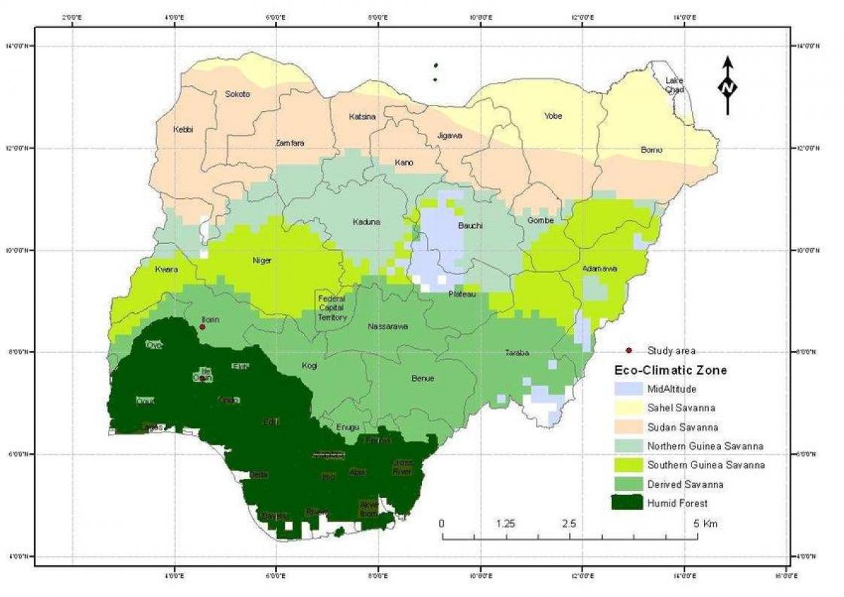
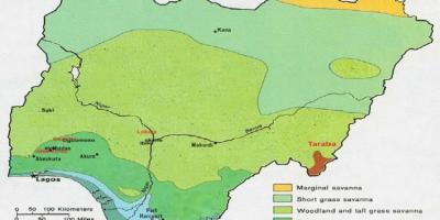
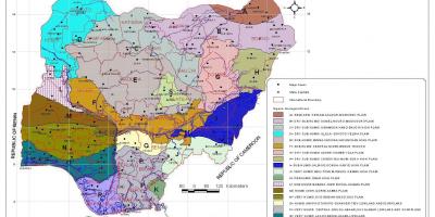
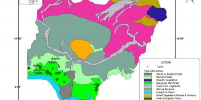
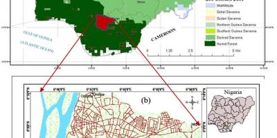
Nigeria's climate map is a vital tool for understanding the diverse weather patterns across the country. This map illustrates the climatic zones that range from the arid northern regions to the humid southern areas. With a geographical expanse of 923,769 square kilometers, Nigeria features various climates, including tropical, savanna, and semi-arid. By examining the climate map, one can see how these climatic conditions influence agriculture, biodiversity, and daily life in different regions.
The northern region of Nigeria is characterized by a dry, tropical climate, with a distinct wet and dry season. During the wet season, which typically lasts from June to September, rainfall can vary significantly, impacting agricultural practices. The climate map shows that areas such as Kano and Sokoto experience lower rainfall compared to southern regions. This understanding is crucial for farmers who depend on seasonal rains for crop cultivation. Conversely, the southern regions, including Lagos and Port Harcourt, enjoy a humid tropical climate with consistent rainfall throughout the year, supporting diverse agricultural activities and lush vegetation.
Historically, Nigeria's climate has shaped its economy and settlements. The indigenous communities in the northern part of the country adapted to the semi-arid conditions by developing pastoral and nomadic lifestyles. In contrast, the fertile lands in the south facilitated the growth of civilizations based on agriculture and trade. The climate map serves as a reminder of how weather patterns have influenced human activities, migration, and economic development throughout Nigeria's history.
Geographically, Nigeria's diverse climate zones are significant for several reasons. The varied climates contribute to Nigeria's rich biodiversity, home to numerous plant and animal species. For instance, the mangrove forests along the coast are critical ecosystems that support fishing and tourism. Additionally, the climate map highlights areas vulnerable to climate change, such as the northern regions facing desertification and the coastal areas at risk of flooding. Understanding these geographical implications is essential for policymakers and environmentalists working to address climate-related challenges.
The practical uses of Nigeria's climate map extend beyond agriculture and biodiversity. It is a valuable resource for urban planners, disaster management agencies, and climate scientists. By analyzing climate trends and historical data, stakeholders can develop strategies to mitigate the impacts of climate change, ensuring sustainable development. Furthermore, the map can help inform tourism strategies, as regions with favorable climates attract visitors year-round, boosting local economies.
In summary, the climate map of Nigeria provides insights into the country's diverse weather patterns, historical context, geographic significance, and practical applications. Understanding these elements is crucial for anyone interested in Nigeria's environmental landscape and its implications for the future. The interplay between climate and geography shapes not only the physical environment but also the lives of millions of Nigerians, making this map an essential tool for comprehending the nation's complexities.
The climate map of Nigeria is an invaluable resource for understanding the intricate relationship between geography and climate. By exploring this map, you can gain a deeper appreciation for Nigeria's environmental diversity and its impact on daily life, agriculture, and economic activities.
-
Nigeria has three main climatic zones: tropical, savanna, and semi-arid, each affecting the lifestyle of its inhabitants.
-
The northern region of Nigeria receives about 500-800 mm of rainfall annually, while the southern region can receive over 2000 mm.
-
The Harmattan, a dry and dusty wind, affects Nigeria during the dry season, usually from late November to mid-March.
-
Nigeria is home to the Niger River, which is the longest river in West Africa, flowing through various climatic zones and supporting agriculture along its banks.
-
The country's diverse ecosystems, ranging from mangroves to savannas, host over 1,000 species of birds and numerous endangered species.
-
Climate change poses a significant threat to Nigeria, with increasing temperatures and unpredictable rainfall patterns affecting food security.
-
The coastal areas of Nigeria are experiencing rising sea levels, which threaten both urban settlements and agricultural lands.
-
Nigeria's agriculture, which contributes about 24% to the GDP, is highly dependent on seasonal rains, making climate maps critical for farmers.
-
The city of Jos, located in the central region, has a unique temperate climate due to its elevation, making it a popular destination for tourists.
-
The Nigerian government has initiated various programs to combat desertification in the northern regions, highlighting the importance of understanding climate patterns.