Explore the Vegetation Zones of Nigeria: A Detailed Map Guide
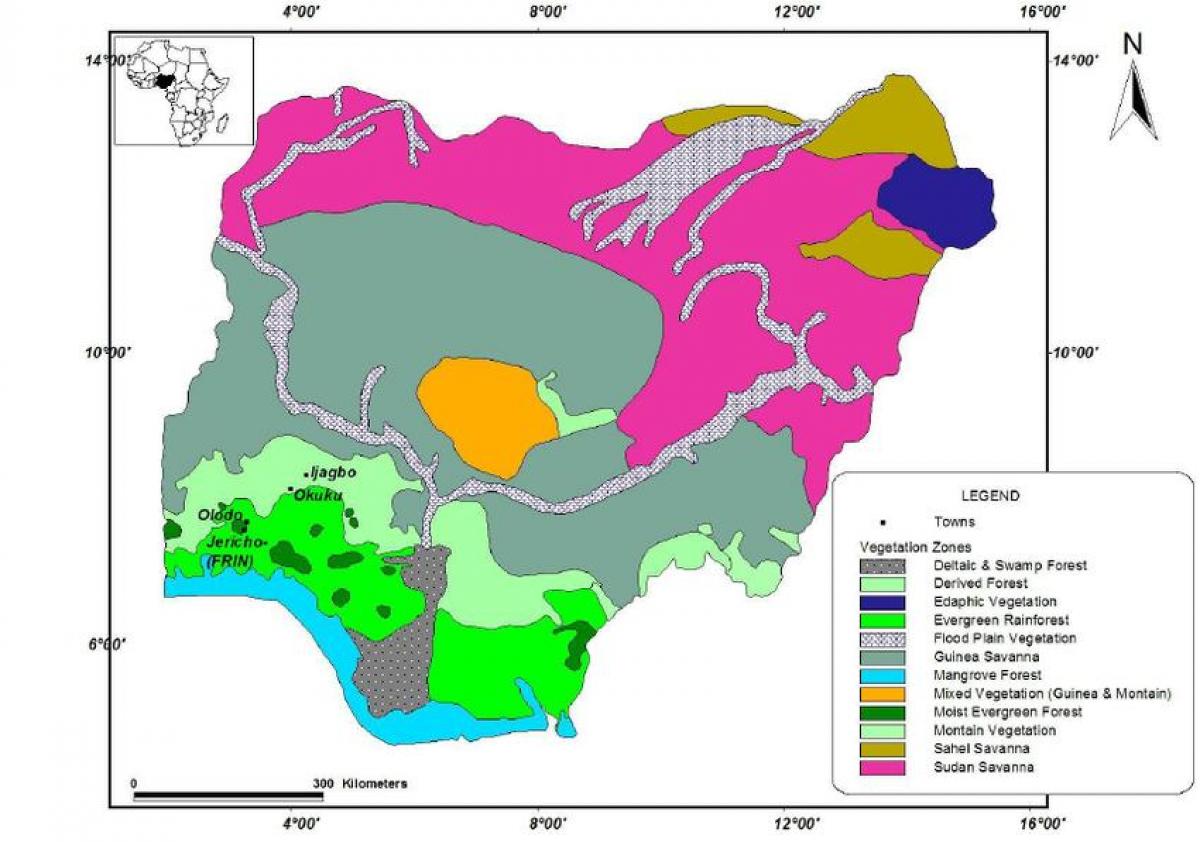
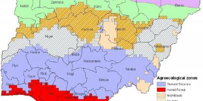
Nigeria is home to a diverse range of vegetation types, each with unique ecosystems and agricultural potentials. The map of Nigeria showing vegetation provides an insightful overview of the country's ecological zones, which can be broadly categorized into five main types: mangroves, rainforests, savannas, dry woodlands, and semi-deserts. Understanding these zones is crucial for various sectors including agriculture, forestry, and conservation, as they directly impact land use and biodiversity.
The southern region of Nigeria is characterized by dense tropical rainforests, which are rich in biodiversity. This area is vital for the country's ecology, housing numerous species of plants and animals, many of which are endemic. The vegetation map highlights these areas, indicating the importance of preserving these ecosystems, which are threatened by deforestation and urban expansion. As you move northwards, the landscape transitions into the savanna zones, which are dominated by grasses and scattered trees. This shift is essential for understanding agricultural practices, as the savanna areas are primarily used for livestock grazing and crop production.
Historically, the vegetation zones of Nigeria have shaped the livelihoods of its people. Indigenous communities have relied on the resources provided by these ecosystems for food, medicine, and shelter. The map reveals how human activity has influenced these areas over time, including the impact of agriculture and urbanization. This historical context is significant, as it sheds light on the challenges that Nigeria faces today in balancing economic development with environmental preservation.
Geographically, Nigeria's vegetation zones play a critical role in climate regulation and soil conservation. The dense forests of the south help in maintaining the water cycle, while the savannas contribute to carbon sequestration. The vegetation map serves as a tool for policymakers and researchers to develop strategies for sustainable land management. By understanding the geographic significance of these zones, stakeholders can better address issues such as land degradation, deforestation, and climate change.
Practically, the map of Nigeria showing vegetation is invaluable for various applications. Farmers can use it to identify the best crops suited for their local environment, while conservationists can focus on areas that require urgent attention. Additionally, this map is essential for educational purposes, helping students and researchers alike to grasp the complexities of Nigeria's ecosystems. Overall, the vegetation map not only illustrates the natural beauty of Nigeria but also serves as a critical tool for sustainable development and environmental management.
In summary, the map of Nigeria showing vegetation is a vital resource for understanding the country's ecological zones. It highlights the importance of preserving these areas while offering practical applications for agriculture and conservation. Explore this map to gain deeper insights into Nigeria's rich geographical tapestry.
-
Nigeria has over 250 ethnic groups, each with unique agricultural practices that are influenced by the local vegetation types.
-
The Niger Delta region, characterized by mangrove forests, is one of the most biodiverse areas in Nigeria and is crucial for fish breeding.
-
Nigeria's rainforests are home to over 10,000 plant species and numerous endangered wildlife, including the Cross River gorilla.
-
The northern part of Nigeria features the Sudano-Sahelian vegetation, which supports pastoralism and is adapted to arid conditions.
-
Agriculture in Nigeria is largely dependent on the vegetation zones; the southern regions grow crops like yams and cassava, while the north focuses on grains like millet and sorghum.
-
Deforestation rates in Nigeria are among the highest in the world, with an estimated loss of 3.5 million hectares of forest annually.
-
The Nigerian government has initiated various reforestation programs to combat the effects of deforestation and restore degraded lands.
-
Nigeria's vegetation types significantly influence the climate; for instance, forests help regulate temperature and rainfall patterns.
-
The rich biodiversity found within Nigerian vegetation zones includes medicinal plants that are integral to traditional healing practices.
-
Understanding Nigeria's vegetation is essential for tackling climate change, as forests play a key role in carbon storage and emissions reduction.