Explore the Map of Nigeria Showing Its Diverse Climatic Zones
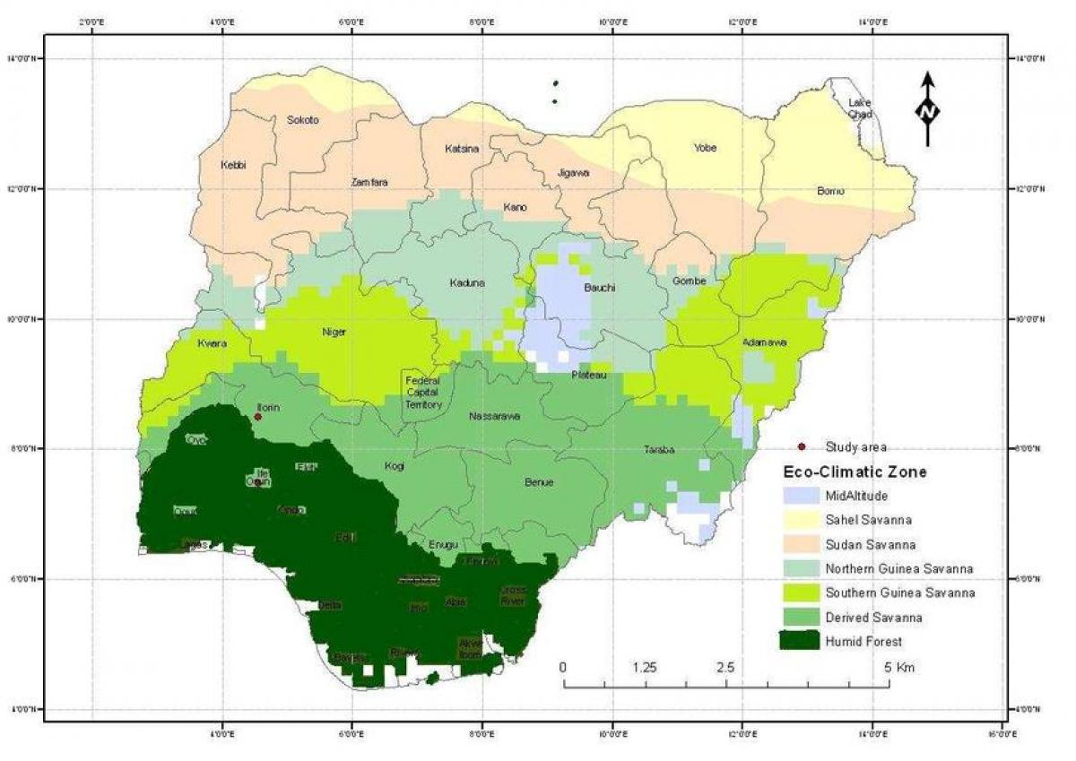
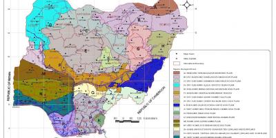
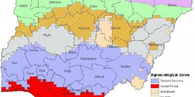
Nigeria, a country known for its rich cultural heritage and diverse landscapes, presents a complex tapestry of climatic zones that are crucial for understanding its ecology and agriculture. The map of Nigeria showing climatic zones reveals essential information about the varying weather patterns across the nation. Nigeria experiences three primary climatic zones: the tropical rainforest in the south, the savanna in the central region, and the arid climate in the north. Each zone plays a significant role in shaping the lifestyle and economic activities of the people inhabiting these areas.
The tropical rainforest zone is characterized by high humidity, ample rainfall, and a rich biodiversity. This region supports a wealth of plant and animal species, making it vital for conservation efforts. The map highlights areas such as Cross River and Akwa Ibom states, where the rainforest thrives. Understanding this zone is crucial for environmental planning, ensuring sustainable practices in agriculture and forestry, and addressing the challenges posed by deforestation.
Moving northward, the savanna zone presents a stark contrast to the lush greenery of the rainforest. This region, which includes parts of states like Kaduna and Kano, has a distinct wet and dry season. The map illustrates how this climate influences agricultural practices, particularly the cultivation of grains and livestock rearing. The savanna's climate supports crops such as millet and sorghum, which are staples in the Nigerian diet. As climate change poses new challenges, this map serves as a tool for farmers and policymakers to adapt to changing weather patterns and implement effective land management strategies.
Further north, the arid climate dominates, marked by low rainfall and high temperatures. This zone, which includes states like Borno and Yobe, faces significant challenges such as desertification and water scarcity. The map provides insights into how these climatic conditions affect the livelihoods of the inhabitants. Understanding the arid zone is essential for developing strategies to combat the effects of climate change, ensuring food security, and promoting sustainable resource management in these vulnerable areas.
Historically, Nigeria's climatic zones have influenced migration patterns, settlement distribution, and economic activities. The map serves as a vital reference for researchers and students who seek to understand the historical context of human settlement and environmental adaptation in Nigeria. Additionally, the geographical significance of these zones is evident in their impact on trade routes, agricultural exports, and even cultural practices. Each zone has distinct traits that shape the cultural identities of the people residing there, making it an integral part of Nigeria's heritage.
In conclusion, the map of Nigeria showing climatic zones is not just a geographical tool; it is a window into the diverse ecological and cultural landscape of the country. By exploring this map, individuals can gain insights into the intricate relationship between climate, agriculture, and livelihoods in Nigeria. This understanding is essential for promoting sustainable development and conserving Nigeria's natural resources for future generations.
By examining the climatic zones of Nigeria through this map, you gain valuable insights into the country's geography and ecology. Explore further to appreciate the diverse climates that shape Nigeria's landscapes and cultures.
-
Nigeria has three main climatic zones: tropical rainforest, savanna, and arid, each significantly affecting the country's biodiversity.
-
The tropical rainforest zone covers about 10 percent of Nigeria, primarily in the southeastern region, where it supports diverse wildlife and plant species.
-
The savanna zone, which occupies a large portion of Nigeria, is crucial for agriculture, especially for growing staple crops like maize and cassava.
-
Northern Nigeria is predominantly arid, characterized by low rainfall and high temperatures, which leads to challenges such as desertification.
-
The Niger River, one of the longest rivers in Africa, flows through different climatic zones, impacting the ecosystems along its banks.
-
Climate change poses significant threats to Nigeria, particularly in the northern regions, where rising temperatures can exacerbate water scarcity.
-
The diversity of climatic zones in Nigeria contributes to the country's rich cultural heritage, with different regions having unique traditions and practices.
-
Nigeria's climatic conditions greatly influence its economy, with agriculture being the primary livelihood for over 70 percent of the population.
-
The country is home to various ecosystems, including mangroves along the coast, which are vital for coastal protection and biodiversity.
-
Environmental policies in Nigeria are increasingly focusing on sustainable practices to combat the adverse effects of climate change across its climatic zones.