Exploring Nigeria's Vegetation Belts: A Comprehensive Map Guide
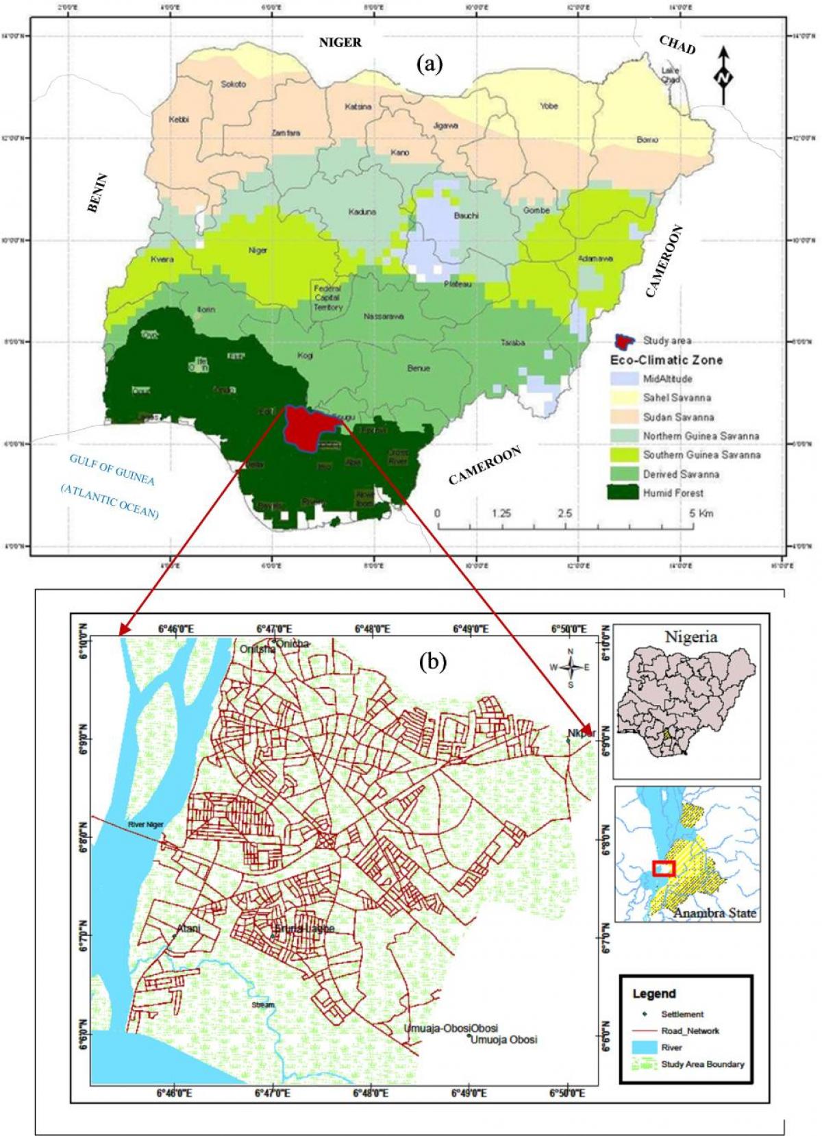
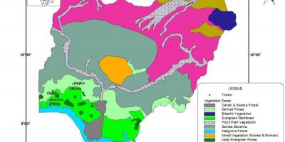
Nigeria, a country known for its rich biodiversity, showcases a variety of vegetation belts that are crucial to its ecology and economy. The map of Nigeria displaying these vegetation belts highlights the different types of flora found across the nation, ranging from tropical rainforests in the south to arid savannas in the north. Understanding these vegetation zones is essential for various sectors, including agriculture, forestry, and environmental conservation. Each belt plays a pivotal role in supporting wildlife, sustaining livelihoods, and contributing to the overall health of the environment.
The southern region of Nigeria is characterized by lush tropical rainforests, which are home to a plethora of plant and animal species. This area receives high rainfall and boasts a dense canopy of trees. The map illustrates how these forests are not only vital for biodiversity but also serve as a resource for timber and non-timber forest products. Additionally, they offer a habitat for many endangered species, emphasizing the need for conservation efforts in these regions.
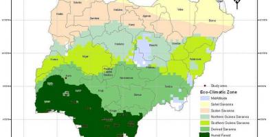
Moving northward, the vegetation belts transition to the Guinea savanna, which is marked by grasslands interspersed with trees. This area supports both agriculture and grazing for livestock, making it crucial for food production in Nigeria. The map indicates how this savanna region is subject to seasonal changes, which affect farming practices and local economies. Furthermore, it highlights the importance of sustainable land management practices to preserve the delicate balance between agricultural needs and environmental health.
As one continues further north, the vegetation shifts to the Sudan savanna and eventually to the Sahel. These areas are characterized by sparse vegetation and are adapted to a drier climate. The map shows distinct features of these belts, including the types of crops that can be cultivated and the unique challenges faced by communities living in these regions, such as desertification and water scarcity. Understanding these challenges is critical for developing effective strategies to combat climate change and ensure food security.
The historical context of Nigeria's vegetation belts is equally fascinating. Over centuries, human activities such as deforestation, agriculture, and urbanization have significantly impacted these ecosystems. The map serves as a historical document, reflecting how land use has evolved and the resulting changes in vegetation. It provides insights into past and present environmental policies and their effectiveness in conserving Nigeria's rich biodiversity.
In practical terms, the map of Nigeria's vegetation belts is an invaluable resource for researchers, policymakers, and educators. It aids in land use planning, conservation efforts, and educational initiatives aimed at raising awareness about Nigeria's unique ecosystems. By understanding the distribution and characteristics of these vegetation belts, stakeholders can make informed decisions that promote sustainable development and environmental stewardship.
The map of Nigeria showcasing vegetation belts is a vital tool for understanding the country's ecological diversity. By exploring these regions further, you gain insights into the environmental challenges and opportunities that lie ahead for Nigeria.
-
Nigeria is home to over 1,000 species of trees, with a significant portion found in its tropical rainforests.
-
The Niger Delta, a key area in Nigeria, features one of the largest mangrove forests in the world, which supports diverse wildlife.
-
Nigeria's savanna regions are crucial for agriculture, providing over 70% of the nation's food production.
-
The country's vegetation belts play a vital role in carbon sequestration, helping to mitigate climate change effects.
-
Nigeria's forests are important for the livelihoods of about 30 million people who depend on forest resources for their daily needs.
-
The transition zone between the rainforest and savanna is known as the derived savanna, which has been transformed by human activity.
-
Historically, Nigeria's vegetation has been altered significantly due to colonial agricultural policies and modern land use practices.
-
The northernmost vegetation belt is the Sahel, which is highly susceptible to desertification due to climate change and human activities.
-
Nigeria's biodiversity hotspots include the Cross River National Park, which is known for its rich flora and fauna diversity.
-
The vegetation map of Nigeria aids in understanding the ecological impact of urbanization and industrialization on natural habitats.