Explore the Map of Nigeria, States and Capitals for Insightful Learning
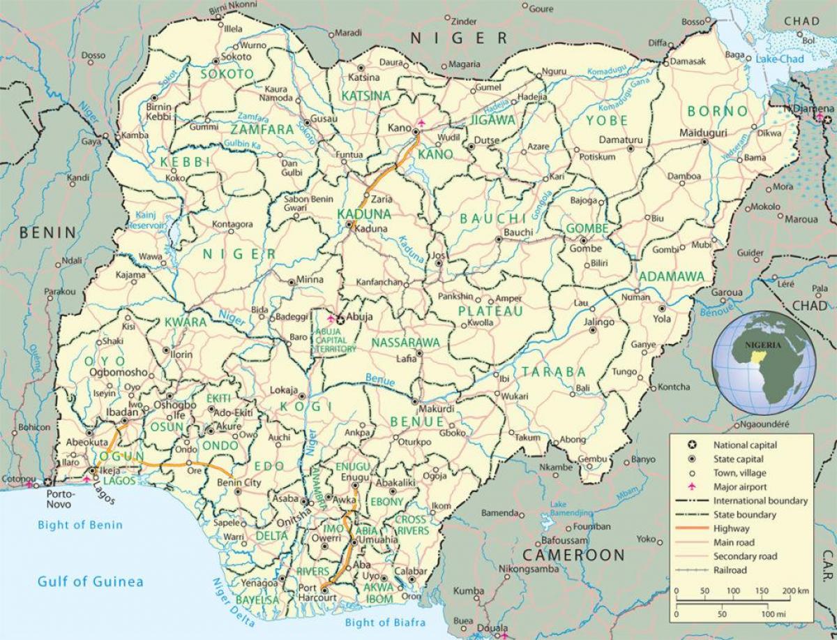
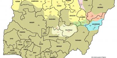
The map of Nigeria showing states and capitals serves as an essential tool for understanding the country's political and geographical landscape. Nigeria is divided into 36 states and one Federal Capital Territory, which houses the capital, Abuja. Each state has its unique characteristics, culture, and history, making the map not just a navigational aid but also a gateway to exploring the rich diversity of the Nigerian nation. The map highlights the geographical positioning of each state, allowing individuals to grasp the regional distribution of resources, populations, and economic activities that shape Nigeria's identity.
Understanding the historical context of Nigeria’s states is crucial. The country gained independence from British colonial rule in 1960, leading to the creation of a federal system that accommodates the diverse ethnic groups and cultures present in the nation. Each state was formed with consideration for ethnic representation and administrative convenience, which is reflected in the organization of the map. The historical evolution of these states, from the initial regions to the current configuration, showcases Nigeria's journey towards nationhood and unity amid diversity.
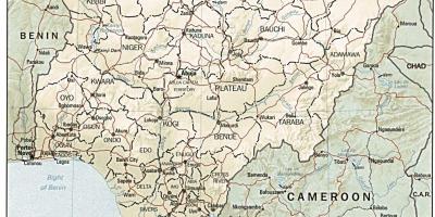
Geographically, Nigeria is situated in West Africa, bordered by Benin to the west, Chad and Cameroon to the east, and Niger to the north. This positioning is significant for trade and cultural exchanges with neighboring countries. The map not only outlines the boundaries of states but also indicates major geographical features such as rivers, mountains, and plains. For instance, the Niger River, one of the longest rivers in Africa, runs through several states, influencing agricultural practices and settlements along its banks. Understanding these geographical features is vital for anyone looking to study Nigeria’s environmental and economic conditions.
The practical uses of the map are numerous. For students, it provides a visual representation that enhances learning about Nigeria’s geography, culture, and political divisions. For businesses, understanding the locations of various states can aid in market analysis and strategic planning. Tourists can also benefit from the map by identifying regions of interest, cultural landmarks, and natural attractions, making it an indispensable resource for anyone engaging with Nigeria. Additionally, the map can be utilized by government and non-profit organizations in planning and resource allocation, ensuring that development efforts are evenly distributed across the country.
In conclusion, the map of Nigeria showing states and capitals is not merely a tool for navigation; it is a comprehensive resource that encapsulates the essence of Nigeria’s geographical and cultural diversity. By exploring this map, individuals can gain insight into the nation's regions, their historical significance, and their roles in contemporary society. Whether for educational purposes, business strategy, or travel planning, this map serves as a vital reference point for all who wish to understand Nigeria better.
In summary, the map of Nigeria is a valuable resource for understanding the complexities of its states and capitals. Explore further to appreciate the rich tapestry of Nigeria’s geography and culture.
-
Nigeria is the most populous country in Africa, with over 200 million residents, making it a significant player on the continent.
-
The Federal Capital Territory, where Abuja is located, was created in 1976 to replace Lagos as the capital due to congestion and overpopulation.
-
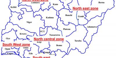
Nigeria is divided into six geopolitical zones: North Central, North East, North West, South East, South South, and South West, each with unique cultures.
-
The largest state by land area is Niger State, while Lagos State is the smallest but the most densely populated, showcasing urbanization in Nigeria.
-
The official language of Nigeria is English, a remnant of its colonial past, but over 500 languages are spoken across the country.
-
The Niger River, which flows through Nigeria, is about 4,180 kilometers long, making it one of the longest rivers in Africa.
-
Nigeria has a rich cultural heritage, with more than 250 ethnic groups, including the Hausa, Yoruba, and Igbo, each represented in different states.
-
Oyo State is often referred to as the cradle of civilization in Nigeria due to its historical significance in the Yoruba kingdom.
-
The country is rich in natural resources, including oil, which accounts for a significant portion of Nigeria's GDP and exports.
-
Nigeria is renowned for its film industry, known as Nollywood, which produces thousands of films each year, contributing to the economy and culture.