Explore the Map of Nigerian Borders: Significance and Insights
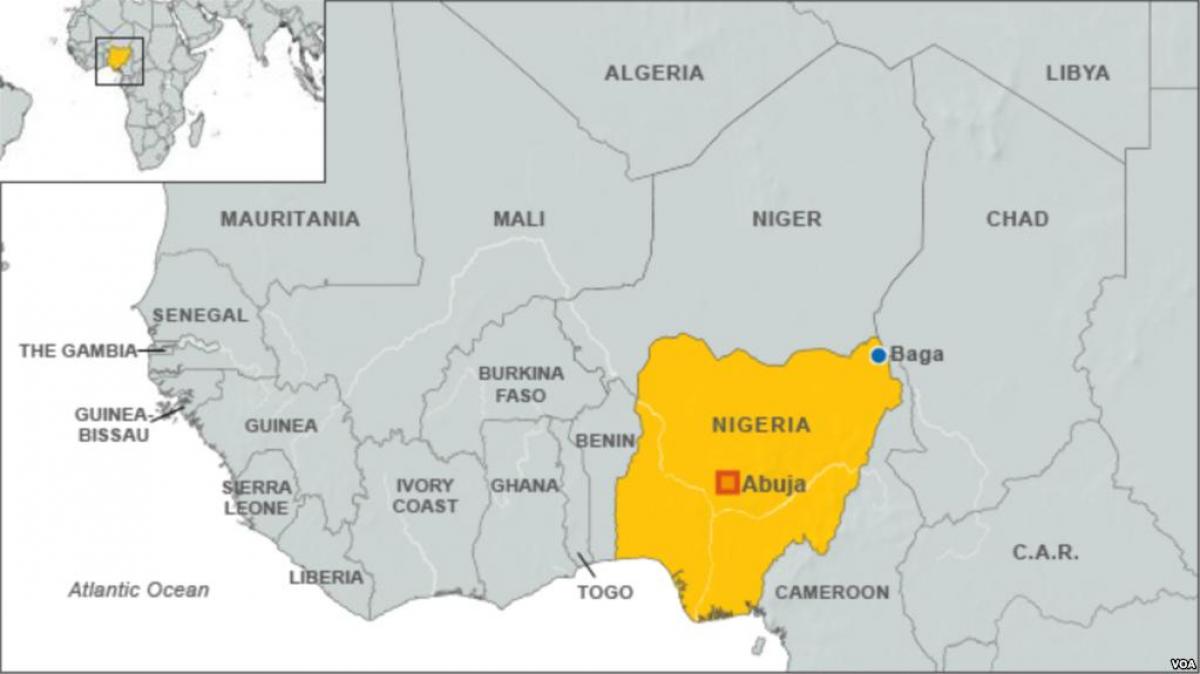
The map of Nigerian borders serves as a crucial tool for understanding the geographical layout and political landscape of Nigeria. This map illustrates Nigeria's boundaries with its neighboring countries: Benin to the west, Niger to the north, Chad to the northeast, and Cameroon to the east. The delineation of these borders is not just a matter of geography; it also reflects the historical, cultural, and political relationships Nigeria maintains with these nations. Understanding these borders is essential for appreciating Nigeria's role in West Africa and the challenges it faces in terms of security, trade, and diplomacy.
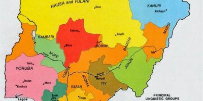
Historically, Nigeria's borders were drawn during the colonial era, often without regard for the ethnic and cultural divisions among various groups. This has led to complex dynamics within Nigeria, where over 250 ethnic groups coexist, sometimes leading to tensions. The borders have also influenced migration patterns, trade routes, and even conflicts, as people move across these lines in search of better opportunities or in response to conflicts. The map of Nigerian borders, therefore, encapsulates not just physical lines on a page but is a representation of the historical narratives that shape the nation today.
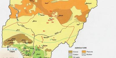
Geographically, Nigeria is strategically located in West Africa, providing access to the Gulf of Guinea through its southern coast. The borders are not merely lines but also encompass diverse ecosystems, from the Niger Delta's mangroves to the northern plains and savannas. This geographical diversity contributes to Nigeria's rich natural resources, including oil, agriculture, and minerals. The map reveals important insights into how these resources are distributed and how they relate to neighboring countries, where trade and economic exchanges occur.
Practically, the map of Nigerian borders is vital for various applications, including tourism, education, and policy-making. For tourists, understanding borders can enhance travel plans and experiences, as they navigate different regions and cultures within Nigeria and its neighboring countries. In education, the map serves as a teaching tool for students learning about geography, history, and social studies. Policymakers use these maps to address border security, trade agreements, and regional cooperation, ensuring that Nigeria can effectively manage its relationships with its neighbors.
In conclusion, the map of Nigerian borders is more than just a cartographic representation; it is a window into Nigeria's identity, history, and future. Understanding this map provides valuable insights into the complexities of Nigerian society and its connections with the wider West African region. Whether for academic purposes, travel planning, or policy formulation, engaging with this map is essential for anyone interested in Nigeria's geographical and cultural landscape.
Exploring the map of Nigerian borders reveals much about the nation's history and relationships with its neighbors. Dive deeper into Nigeria's geography to appreciate its complexities and beauty.
-
Nigeria shares borders with four countries: Benin, Niger, Chad, and Cameroon.
-
The total length of Nigeria's land borders is approximately 4,047 kilometers.
-
The Nigeria-Benin border is known for its bustling trade activities, particularly in agricultural products.
-
Niger is Nigeria's largest neighbor by land area, covering approximately 1,267,000 square kilometers.
-
Chad and Nigeria share a border that includes Lake Chad, a vital resource for both countries.
-
The historical agreement that defined Nigeria's borders was the 1885 Berlin Conference, where European powers divided Africa.
-
Many ethnic groups, like the Kanuri and Hausa, live near the borders with Chad and Niger, influencing cross-border relations.
-
The porous nature of Nigeria's borders has led to challenges in security, including smuggling and illegal immigration.
-
The Nigeria-Cameroon border is particularly significant due to historical disputes over territory, like the Bakassi Peninsula.
-
Nigeria's border regions are rich in cultural diversity, with various festivals and traditions celebrated by ethnic groups residing near the borders.