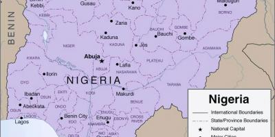
Explore the Detailed Map of Nigeria with 36 States and Capitals
The map of Nigeria illustrates the country's 36 states, each with unique characteristics and cultural heritage. This detailed representation is not just a geographical tool; it serves as a gateway to understanding Nigeria's diverse landscape, from the coastal regions of Lagos to the mountainous terrains of Jos. Each state has its own capital, which plays a pivotal role in local governance and administration. By exploring this map, one can appreciate the vastness and variety of Nigeria, which is home to over 200 million people and hundreds of ethnic groups.
Understanding the layout of Nigeria through its map is essential for grasping the nation's historical context. Nigeria gained independence from British colonial rule in 1960, and since then, its states have been restructured multiple times to better reflect the demographic and cultural diversity of the population. The map highlights the importance of regional governance and the distribution of resources, which have been central to Nigeria's political discourse. For instance, the northern states, predominantly Muslim, contrast with the southern states that are largely Christian, showcasing the country's rich tapestry of cultures.
Geographically, Nigeria's map reveals significant features such as the Niger and Benue Rivers, which converge at Lokoja, forming the backbone of the country’s waterway system. These rivers are crucial for transportation, agriculture, and fishing. Additionally, the map illustrates Nigeria's varied climate zones, from the arid northern regions to the humid coastal areas in the south. This geographic diversity significantly influences local economies, agricultural practices, and settlement patterns.
The practical uses of the map extend beyond education and tourism; it is an essential resource for businesses, researchers, and policymakers. Investors looking to establish operations in Nigeria can utilize the map to identify potential markets and understand regional dynamics. Moreover, researchers studying demographic trends or environmental changes rely on detailed maps to analyze data effectively. The map of Nigeria with its 36 states serves not only as a reference point but also as a strategic tool for economic and social planning.
In conclusion, the map of Nigeria with its 36 states offers valuable insights into the country’s geography, culture, and history. It is a vital resource for anyone looking to explore Nigeria's rich diversity and understand the dynamics at play in this vibrant nation. Whether you are a traveler, a student, or a professional, this map can enhance your appreciation of Nigeria's complexities and opportunities.
Exploring the map of Nigeria provides a deeper understanding of its diverse regions. We encourage you to delve further into Nigerian geography and discover the wonders this country has to offer.
-
Nigeria is the most populous country in Africa, with over 200 million residents, making the map of its 36 states crucial for understanding population distribution.
-
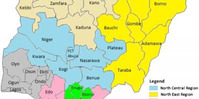
The country is divided into six geopolitical zones, which group states based on cultural and geographical similarities for better governance.
-
Each of Nigeria's 36 states has a unique capital, with Abuja being the Federal Capital Territory, strategically located in the center of the country.
-
Lagos, one of Nigeria's states, is the largest city in Africa and serves as the country's economic hub, significantly impacting the national economy.
-
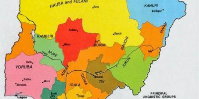
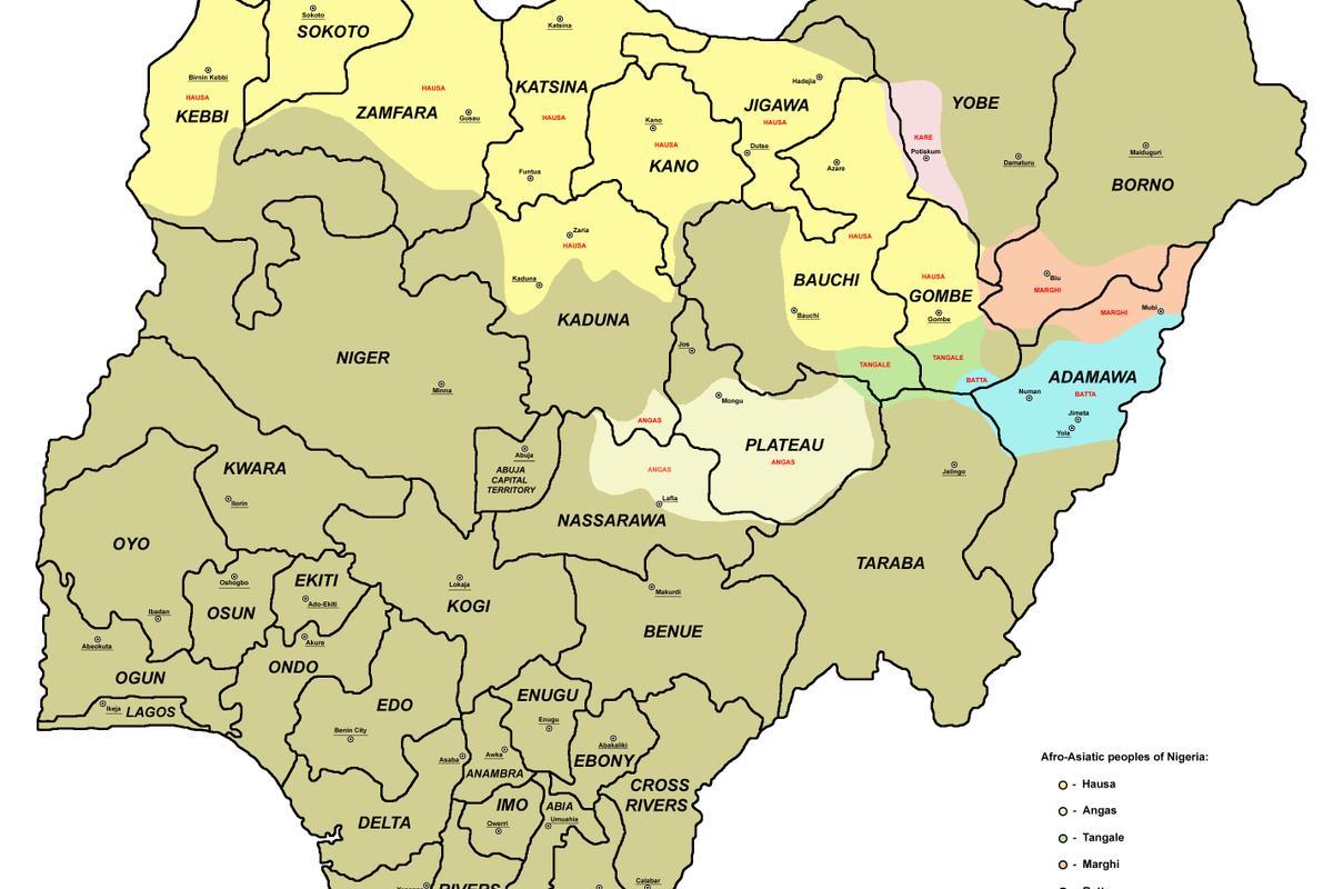
Nigeria is home to over 250 ethnic groups, with the three largest being the Hausa, Yoruba, and Igbo, evident in the cultural diversity represented on the map.
-
The Niger River, the longest river in Nigeria, flows through several states and is essential for transportation, irrigation, and fishing.
-
Nigeria has a variety of climates, from the tropical rainforest in the south to the arid regions in the north, which is clearly depicted on the map.
-
The country has rich natural resources, including oil and gas, primarily concentrated in the Niger Delta region, influencing the economic landscape of various states.
-
Nigeria was divided into regions during British colonial rule, and the current 36-state structure was established in 1976 to enhance local governance.
-
The map of Nigeria also highlights important national parks and reserves, such as Yankari National Park, which is vital for biodiversity and tourism.