Explore the Map of Nigeria: Insights into the Nigerian Flag and Geography
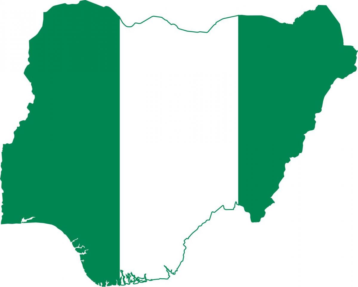
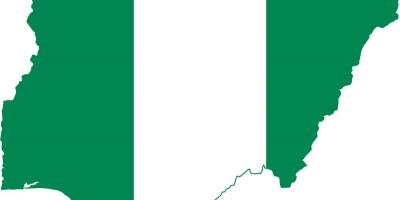
The map of Nigeria is an essential tool for understanding the diverse geography and rich culture of this West African nation. Nigeria, often referred to as the "Giant of Africa," is not only the most populous country on the continent but also a hub of cultural and economic activities. The map illustrates various geographical features such as rivers, mountains, and states, while also showcasing the iconic Nigerian flag. The flag, with its vibrant green and white colors, symbolizes the country's lush vegetation and peace, respectively, making it an integral part of Nigeria's identity.
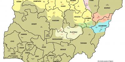
The historical context of Nigeria’s map is deeply intertwined with its colonial past. During the late 19th and early 20th centuries, Nigeria was delineated by colonial rulers, which laid the groundwork for its current boundaries. The map shows the division into 36 states and the Federal Capital Territory, Abuja. Each state has its unique cultural heritage and resources, which contribute significantly to the nation's economy. Understanding this geographical layout is crucial for appreciating the socio-political dynamics within Nigeria today.
Geographically, Nigeria is rich in diversity, featuring various landscapes from coastal areas in the south to the arid regions in the north. Major rivers such as the Niger and Benue are highlighted on the map, serving as vital water sources that support agriculture and transportation. The country's geographic significance is further emphasized by its strategic location in West Africa, bordered by Benin, Niger, Chad, and Cameroon. This position has historically made Nigeria a center for trade and cultural exchange, which is evident in its rich tapestry of ethnic groups and languages.
Practical uses of the map of Nigeria extend beyond academic purposes. For businesses and investors, the map provides insights into regional markets and logistics, helping make informed decisions. Tourists can benefit from the map by identifying key attractions and navigating through the various states. Additionally, educators utilize this map to teach students about geography, history, and cultural studies, emphasizing the importance of Nigeria’s diverse regions.
In summary, the map of Nigeria is more than just a representation of geographical boundaries. It is a gateway to understanding the country's identity, history, and cultural richness. The vibrant Nigerian flag, prominently featured, serves as a reminder of the nation’s unity amidst diversity. By exploring the map, one gains a deeper appreciation of Nigeria's vast landscapes and its role in the African continent.
The map of Nigeria serves as a valuable resource for anyone looking to explore the country's geography and cultural heritage. By delving into its details, you can uncover the many stories that shape Nigeria today.
-
Nigeria is the most populous country in Africa, with over 200 million people.
-
The Nigerian flag was designed in 1959 by a student named Michael Taiwo Akinkunmi.
-
Nigeria is divided into 36 states and one Federal Capital Territory, Abuja.
-
The Niger River, one of the longest rivers in Africa, flows through Nigeria and is crucial for trade and transportation.
-
Nigeria has over 250 ethnic groups, with the three largest being the Hausa, Yoruba, and Igbo.
-
The country is rich in natural resources, including oil, natural gas, and agricultural products.
-
Nigeria's economy is one of the largest in Africa, largely driven by oil exports and agriculture.
-
The country has a diverse climate, ranging from tropical in the south to arid in the north.
-
Nigeria is home to the largest film industry in Africa, known as Nollywood, producing thousands of films each year.
-
The country boasts numerous national parks and wildlife reserves, showcasing its rich biodiversity.