Explore the Map of Nigeria with Major Cities and Landmarks
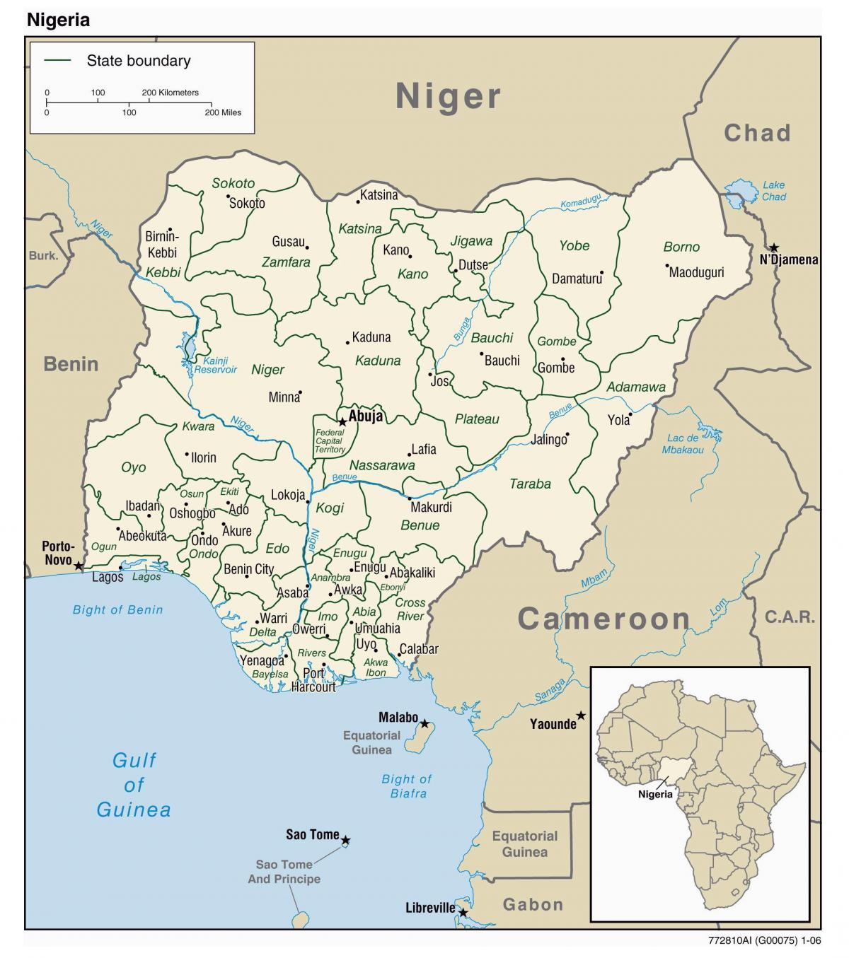
A map of Nigeria with cities is a vital tool for understanding the geographical layout, cultural diversity, and historical significance of this West African nation. Nigeria, known for its rich cultural heritage and vast natural resources, is home to over 200 million people and more than 250 ethnic groups. The map highlights important cities such as Lagos, Abuja, and Port Harcourt, providing insights into their roles as economic, political, and cultural centers in Nigeria. This visual representation not only showcases the urban areas but also illustrates the country's diverse landscapes, from the coastal regions along the Atlantic Ocean to the arid terrains in the north.
Understanding the map of Nigeria is essential for various reasons. Firstly, it serves as a practical resource for tourists and residents alike, offering guidance on travel routes, city locations, and points of interest. For instance, Lagos, the largest city in Nigeria, is a bustling metropolis known for its vibrant nightlife, cultural events, and economic opportunities. In contrast, Abuja, the capital city, is strategically located in the geographic center of Nigeria and serves as the seat of government, making it significant for both political and administrative purposes.
Historically, maps of Nigeria reflect the country's colonial past and its journey towards independence. The British colonial administration imposed boundaries that did not consider the existing ethnic and cultural divisions, leading to complex inter-group dynamics that are still evident today. The map reveals historical trade routes and cities that played pivotal roles in the transatlantic slave trade and later in Nigeria's economic development. By examining these historical contexts, one can gain a deeper appreciation for the current socio-political landscape of Nigeria.
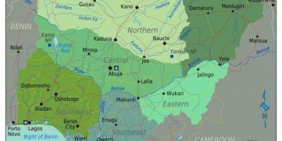
Geographically, Nigeria's map is significant as it showcases various terrains, climates, and natural resources. The country has several ecological zones, including savannahs, rainforests, and mangroves. This diversity not only influences agricultural practices but also affects the lifestyle of its inhabitants. Understanding these geographical features is crucial for environmental studies, urban planning, and resource management. Furthermore, the map indicates major rivers such as the Niger and Benue, which are essential for transportation, irrigation, and fishing, contributing to the livelihoods of many Nigerians.
In practical terms, the map of Nigeria with cities is invaluable for researchers, students, and professionals engaged in various fields. Urban planners can utilize the map to strategize city development and infrastructure projects, while businesses can identify potential markets and logistical routes. Additionally, educators can use it as a teaching tool to enhance students' understanding of geography, history, and cultural studies. By incorporating a map of Nigeria with cities into educational curricula, teachers can foster a deeper understanding of the country's complexities among students.
In conclusion, a map of Nigeria with cities is more than just a visual representation of geographical data; it is a gateway to understanding the rich tapestry of Nigeria's culture, history, and geography. Whether for travel, research, or education, this map serves as an essential resource that encourages further exploration of Nigeria's diverse landscapes and vibrant cities.
Exploring the map of Nigeria unveils the rich cultural and geographical diversity of the nation. Dive deeper into Nigeria's fascinating geography and uncover more about its cities and landscapes.
-
Nigeria is the most populous country in Africa, with over 200 million inhabitants.
-
Lagos is not only the largest city in Nigeria but also one of the fastest-growing cities in the world.
-
Nigeria has 36 states and one Federal Capital Territory, where Abuja is located.
-
The Niger River, which flows through Nigeria, is the third longest river in Africa, spanning approximately 4,180 kilometers.
-
Nigeria is rich in natural resources, including oil, which accounts for a significant portion of its economy.
-
The country boasts over 250 ethnic groups, with the Hausa, Igbo, and Yoruba being the three largest.
-
Nigeria's geography includes diverse ecosystems ranging from mangrove swamps to savannah and semi-arid regions.
-
The city of Kano is known for its historic trade and is one of the oldest cities in Nigeria, dating back over 1,000 years.
-
Nigeria has a wide variety of languages spoken, with over 500 languages, making it one of the most linguistically diverse countries in the world.
-
The country is famous for its Nollywood film industry, which is one of the largest film producers globally, contributing to its cultural identity.