Explore the Blank Map of Nigeria: Importance and Uses
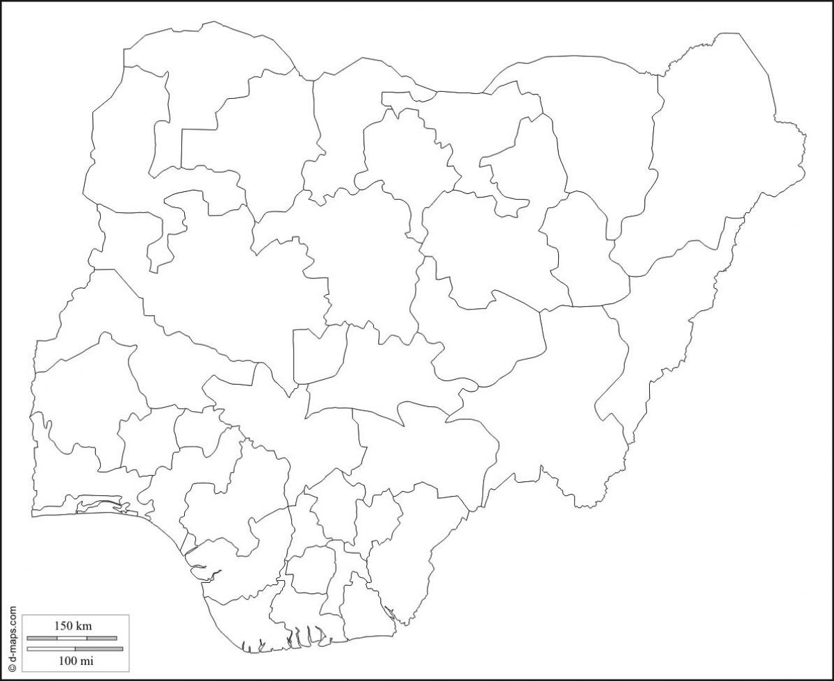
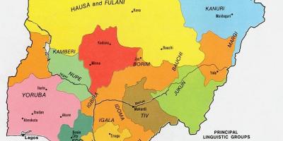
A blank map of Nigeria serves as a vital tool for understanding the country's geography, culture, and history. This map provides a simple yet effective way to visualize the nation’s diverse regions, cities, and geographical features without the distraction of labels or colors. Each blank map allows users to engage with the landscape directly, making it ideal for educational purposes, geographic studies, and planning initiatives. As Nigeria is home to over 250 ethnic groups and a wide range of geographic features, a blank map becomes indispensable for teachers, students, and researchers alike.
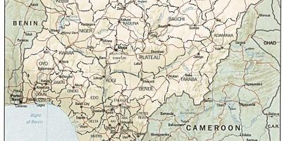
Historically, Nigeria has been shaped by its geographic context. The country is located in West Africa and is bordered by Benin, Niger, Chad, and Cameroon. Its coastline along the Gulf of Guinea presents a significant avenue for trade and cultural exchange. The blank map highlights Nigeria's major rivers, including the Niger and Benue rivers, which are crucial for transportation and agriculture. Understanding these features through a blank map allows individuals to appreciate the historical trade routes that have influenced Nigeria's development.
The geographic significance of a blank map of Nigeria cannot be overstated. Nigeria is known for its vast landscapes that range from the arid regions in the north to the lush rainforests in the south. A blank map allows for the identification of various geographical zones, including savannahs, wetlands, and mountainous terrains. This is particularly important for environmental studies and planning, as different regions face unique challenges such as desertification, deforestation, and urbanization. By engaging with a blank map, individuals can better understand the country’s topography and the environmental issues that arise from it.
In practical terms, a blank map of Nigeria is useful for a variety of applications. Educators often use it for geography lessons, enabling students to label important cities, states, and geographical features. It can also serve as a resource for businesses looking to expand into Nigeria, as understanding the regional layout can influence market entry strategies. Additionally, government agencies and non-profit organizations may utilize blank maps for planning development projects, conducting surveys, or analyzing demographic data. The versatility of a blank map makes it an essential resource across multiple sectors.
In conclusion, the blank map of Nigeria offers a wealth of information and serves numerous important functions. It is a valuable educational tool, a resource for historical and geographic exploration, and a practical guide for planning and policy-making. Engaging with this map helps foster a deeper understanding of Nigeria's rich and diverse landscape, paving the way for informed decisions and meaningful discussions about the country's future. Whether for academic purposes or personal interest, a blank map of Nigeria is a gateway to discover the complexities of this dynamic nation.
Exploring the blank map of Nigeria opens doors to understanding the nation’s diverse geography and history. Dive deeper into Nigerian geography and uncover more about its rich landscapes and cultures.
-
Nigeria is the most populous country in Africa, with over 200 million inhabitants.
-
The Niger River is the longest river in Nigeria, stretching over 4,180 kilometers.
-
Nigeria has 36 states and one Federal Capital Territory, which is Abuja.
-
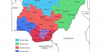
The country is divided into six geopolitical zones, which help in political representation.
-
Nigeria is home to over 250 ethnic groups, with the three largest being the Hausa, Yoruba, and Igbo.
-
The country’s coastline along the Gulf of Guinea spans approximately 853 kilometers.
-
Lake Chad, located in the northeastern part of Nigeria, is one of the largest lakes in Africa, although it has dramatically shrunk in size in recent years.
-
Nigeria is rich in natural resources, including oil, natural gas, and minerals like tin and coal.
-
The Nigerian Highlands, located in the central region, are known for their mountainous terrain and scenic beauty.
-
The country experiences diverse climate conditions, from arid in the north to humid in the south, which affects agriculture and lifestyle.