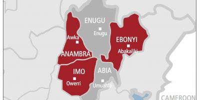
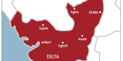
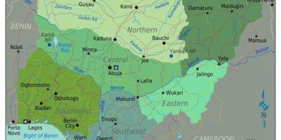
Explore the Nigerian Map: States, Geography, and Their Significance
The Nigerian map is more than just a visual representation; it is a vital tool for understanding the geographical, cultural, and administrative landscape of Nigeria. The country is divided into 36 states and one Federal Capital Territory, each with its unique characteristics and significance. The map showcases these divisions clearly, providing insights into the regional diversity and distribution of Nigeria's vast population. From the bustling cities of Lagos and Abuja to the serene landscapes of Enugu and Ekiti, the map highlights the variety that makes Nigeria a fascinating place.
Understanding the Nigerian map holds immense importance for several reasons. Firstly, it serves as an educational resource for students, researchers, and travelers who wish to gain knowledge about Nigeria’s political boundaries and regional differences. Each state has its own local government structure, languages, and cultural practices, which are essential for anyone looking to explore Nigeria's rich heritage. Additionally, the map is a practical guide for businesses and investors who aim to tap into Nigeria's market potential. Knowing the geographical layout can help in making informed decisions about where to establish operations or target specific demographics.
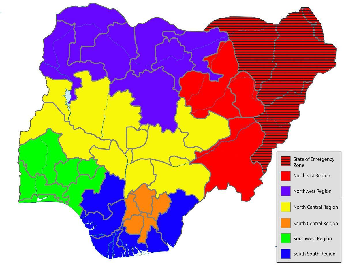
Historically, the Nigerian map has evolved through various political changes, colonization, and independence. The borders of the states were drawn during British colonial rule, which significantly influenced the current administrative divisions. Understanding this historical context is crucial, as it helps to explain the existing cultural and ethnic complexities within the nation. The map also reflects the impact of colonialism on Nigeria's socio-political landscape, as many ethnic groups were grouped together or separated by arbitrary borders set by colonial powers. This has led to ongoing discussions about identity, nationality, and resource distribution in modern Nigeria.
Geographically, Nigeria's map displays significant features such as the Niger and Benue Rivers, which are vital for transportation and agriculture. The country is endowed with diverse ecosystems, from the arid regions in the north to the lush rainforests in the south. This diversity not only affects the climate and agriculture but also influences the economic activities prevalent in each state. For example, while northern states may focus on agriculture and livestock, southern states often engage in oil production and trade due to their proximity to coastal areas.
In practical terms, the Nigerian map is used by various stakeholders, including government agencies, NGOs, and international organizations, for planning and development purposes. It aids in disaster management, urban planning, and resource allocation. Additionally, the map can help tourists navigate through Nigeria’s attractions, from cultural heritage sites to natural wonders, enriching their travel experience. As an essential resource, the Nigerian map fosters a deeper understanding of the country and encourages sustainable development across its regions.
The Nigerian map is an invaluable resource that offers insights into the country's cultural and geographical diversity. By exploring this map, you can gain a deeper appreciation of Nigeria's rich heritage and varied landscapes.
-
Nigeria is divided into 36 states and one Federal Capital Territory, Abuja, which serves as the political center of the country.
-
The northern region of Nigeria is predominantly Muslim, while the southern region is primarily Christian, reflecting the nation's diverse religious landscape.
-
Lagos, Nigeria's largest city, is not only a state but also a major financial hub in Africa, often referred to as the 'city of excellence.'
-
The Niger River, one of the longest rivers in Africa, flows through several states in Nigeria, providing essential water resources for agriculture and transportation.
-
Benue State is known as the 'Food Basket of the Nation' due to its fertile land and agricultural productivity, particularly in crop production.
-
Nigeria has over 250 ethnic groups, with the three largest being the Hausa, Yoruba, and Igbo, each dominant in different regions of the map.
-
The map reflects Nigeria's oil-rich regions, particularly in the Niger Delta, which are crucial for the country's economy but also face environmental challenges.
-
Abuja was established as the capital of Nigeria in 1991, replacing Lagos in an effort to create a more centrally located administrative hub.
-
The country experiences a variety of climates, from the arid climate in the north to the tropical climate in the south, significantly influencing its geography.
-
Nigeria is the most populous country in Africa, with over 200 million people, making the understanding of its map essential for effective governance and resource allocation.