Understanding Nigeria's Geopolitical Zones: A Detailed Map Guide
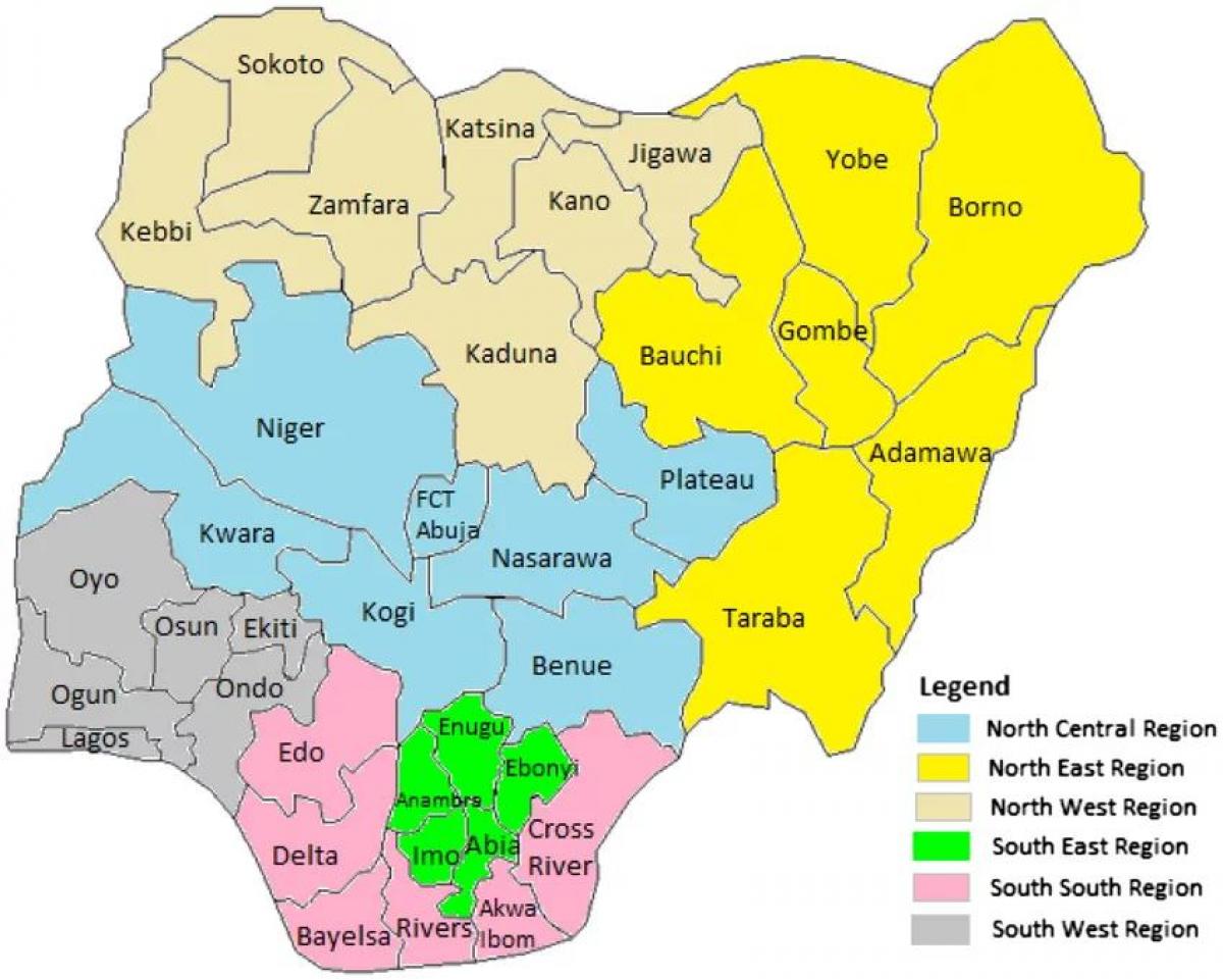
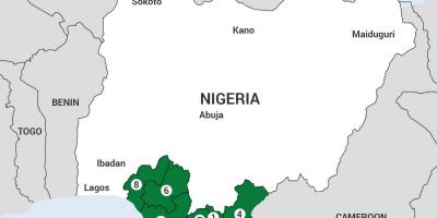
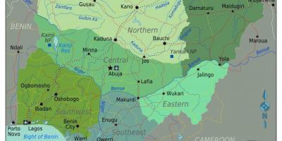
The map of Nigeria showcasing the geopolitical zones provides a vital visual representation of the country's administrative divisions. Nigeria is divided into six geopolitical zones: North Central, North East, North West, South East, South South, and South West. Each zone reflects the diverse ethnicities, cultures, and historical backgrounds of the regions. This map serves not only as a navigational guide but also as a tool for understanding the complexities of Nigeria's socio-political landscape.
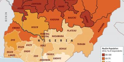
The significance of the geopolitical zones in Nigeria cannot be overstated. They are essential for political representation, resource allocation, and regional development planning. Each zone plays a crucial role in the national economy, with varying degrees of agricultural, industrial, and technological activities. For instance, the South West zone is known for its commercial activities and urbanization, while the North East is recognized for its agricultural potential despite facing challenges such as insecurity.
Historically, the creation of these geopolitical zones dates back to the early 1990s, aimed at addressing regional imbalances and promoting equitable development across the country. The zones were designed to ensure that various ethnic groups have a voice in the governance of the nation, thereby fostering national unity. However, the historical context also reveals the challenges Nigeria faces, such as ethnic tensions and regional disparities, which are often highlighted in discussions surrounding these zones.
Geographically, the map illustrates the diverse landscapes of Nigeria, from the arid regions of the North to the lush, oil-rich areas of the South. The North Central zone, for instance, is characterized by its middle-belt region, which serves as a cultural melting pot, while the South South is known for its significant oil reserves, crucial to Nigeria's economy. Understanding these geographical features helps one appreciate the resource distribution and the economic activities prevalent in each zone.
Practically, this map can be utilized by policymakers, businesses, and researchers. For instance, businesses looking to invest in Nigeria can use this map to identify potential markets and understand regional dynamics. Policymakers can assess the needs of each zone based on demographic data and resource availability, enabling them to craft targeted development strategies. Additionally, educators and students can use the map as a learning tool to delve deeper into Nigeria's rich cultural and geographical diversity.
In conclusion, the map of Nigeria showing the geopolitical zones is more than just a geographical representation; it is a reflection of the country's diverse culture, history, and socio-economic dynamics. Understanding these zones enriches our comprehension of Nigerian society and its complexities, encouraging further exploration and appreciation of its geography.
This map serves as a gateway to understanding Nigeria's rich cultural and geographical diversity. We encourage you to explore more about Nigeria's zones and their significance to the nation's development.
-
Nigeria is divided into six geopolitical zones, each representing different ethnic groups and cultural backgrounds.
-
The North West zone is the largest in terms of land area, encompassing states like Kano and Kaduna.
-
The South East zone is predominantly inhabited by the Igbo ethnic group, known for their vibrant culture and entrepreneurship.
-
Lagos, located in the South West zone, is Nigeria's largest city and a major financial hub in Africa.
-
The North East zone is home to the Lake Chad Basin, an important water source for the region, but has faced environmental challenges.
-
Nigeria's oil production is concentrated in the South South zone, which includes the Niger Delta, one of the richest oil regions in the world.
-
The North Central zone, often referred to as the 'Middle Belt', is known for its diverse ethnic composition and agricultural activities.
-
Each geopolitical zone in Nigeria has its own unique festivals and cultural practices, reflecting the rich diversity of the country.
-
The South South zone has been historically significant due to its oil wealth, which has influenced Nigeria's economy and politics.
-
Nigeria is the most populous country in Africa, with over 200 million residents, making the understanding of its geopolitical zones crucial for effective governance.