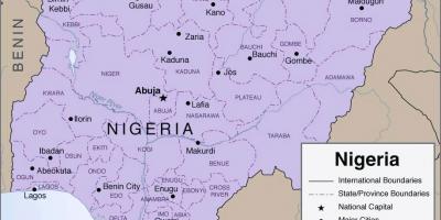
Explore the Major Roads in Nigeria with Our Detailed Map
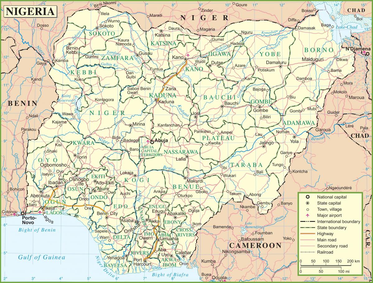
Nigeria, known for its diverse culture and vast landscapes, has a complex network of major roads that connect its cities and rural areas. The map of Nigeria showcasing these roads is not only essential for navigation but also plays a crucial role in the economic and social development of the country. With over 200,000 kilometers of roads, Nigeria's road network facilitates transportation of goods, services, and people across its 36 states and the Federal Capital Territory, Abuja.
The major roads depicted on the map include significant highways such as the Lagos-Ibadan Expressway, which is a critical route for trade between the economic hub of Lagos and the rest of the country. This expressway is one of the busiest in Nigeria, serving as a vital artery for commerce and travel. Other important roads include the Abuja-Kaduna Expressway, connecting the capital city to the northern regions, and the Benin-Ore Road, which links the southern states to the west. These roads enhance accessibility, enabling economic activities and fostering regional development.
Historically, the development of Nigeria's road network has been influenced by colonial legacies and post-independence planning. The British colonial administration established many of the early roads, primarily to facilitate resource extraction. After independence in 1960, Nigeria invested in expanding and upgrading its road infrastructure, recognizing its importance for national integration and development. The map of Nigeria showing these major roads reflects this historical evolution, highlighting road construction projects that have shaped the country's connectivity.
Geographically, Nigeria’s major roads traverse a variety of terrains, from coastal regions in the south to the arid landscapes in the north. The map illustrates how these roads navigate Nigeria's diverse environments, including challenging areas like the Niger Delta and the hilly terrains of the Middle Belt. This geographic context is essential for understanding the implications of road construction on local ecosystems and communities. Roads significantly impact land use patterns, agricultural practices, and urbanization trends, making them integral to Nigeria's socio-economic landscape.
In practical terms, the map of Nigeria's major roads serves multiple purposes. For travelers, it provides a guide to navigating the country efficiently, reducing travel time and enhancing safety. For businesses, it is a critical tool for logistics and supply chain management, helping companies determine the best routes for transporting goods. Additionally, policymakers and urban planners use this map to identify areas needing infrastructure development and to plan for future road expansions to meet the growing demands of a rapidly urbanizing population.
In conclusion, understanding the major roads of Nigeria through the map is vital for anyone interested in the country's geography, economy, and culture. This map not only helps navigate through Nigeria but also offers insights into the historical and current significance of these roadways, highlighting their role in shaping the nation.
The map of Nigeria showcasing its major roads is an invaluable resource for anyone looking to explore the country's geography and infrastructure. By understanding these connections, you can appreciate the dynamic nature of Nigeria's development and the opportunities for travel and trade.
-
Nigeria has the largest road network in West Africa, with over 200,000 kilometers of roads connecting its diverse regions.
-
The Lagos-Ibadan Expressway is one of the busiest roads in Nigeria, carrying a significant volume of traffic daily due to its importance for trade and commuting.
-
The Federal Roads Maintenance Agency (FERMA) is responsible for maintaining federal roads in Nigeria, ensuring they remain safe and functional for users.
-
Road transport accounts for about 90 percent of the total freight movement in Nigeria, highlighting the critical role of roads in the economy.
-
The Abuja-Kaduna Expressway, completed in 2018, significantly reduced travel time between Nigeria's capital and the northern regions, improving economic ties.
-
In rural areas, poor road conditions can hinder access to markets and services, affecting local economies and livelihoods.
-
The Niger Delta region is known for its challenging road conditions due to frequent flooding and erosion, impacting transportation and accessibility.
-
Historically, many roads in Nigeria were built for colonial purposes to support resource extraction and transportation of goods to ports.
-
Nigeria's major roads also face challenges such as traffic congestion, road safety issues, and inadequate maintenance, impacting travel efficiency.
-
The government is investing in road infrastructure projects to enhance connectivity and support economic growth, recognizing the importance of a robust road network.