Explore the Nigeria Regional Map: Understanding Nigeria's Geography
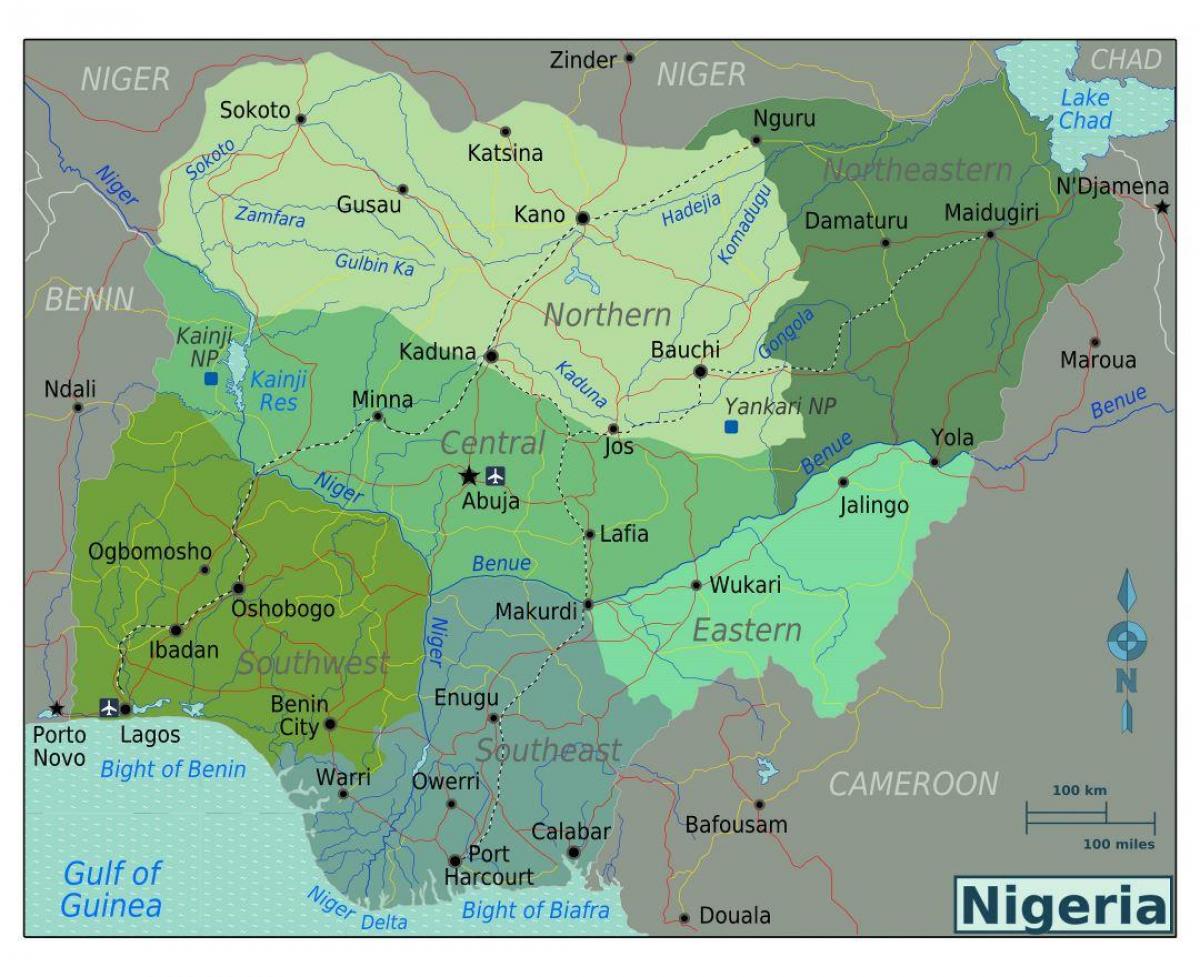
The Nigeria regional map is an essential tool for understanding the diverse geographical landscape of this West African nation. It showcases Nigeria's 36 states and the Federal Capital Territory, each with its unique culture, economy, and history. This map not only serves as a visual representation of Nigeria's political boundaries but also highlights the rich ethnic diversity and various geographical features, such as rivers, mountains, and forests, that define the country.
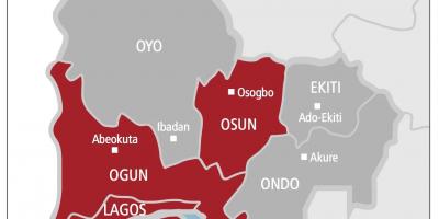
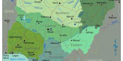
Nigeria is divided into six geopolitical zones: North Central, North East, North West, South East, South South, and South West. Each zone has its own distinct cultural and linguistic characteristics. For instance, the North East region is known for its significant Hausa and Fulani population, while the South West is home to the Yoruba people. Understanding these divisions through the Nigeria regional map is crucial for anyone looking to grasp the complexities of Nigeria’s social structure and cultural dynamics.
Historically, the map is significant as it reflects the colonial imposition of borders that did not consider the ethnic and cultural alliances of the indigenous peoples. This historical context is vital for comprehending current socio-political issues in Nigeria, such as ethnic conflicts and regional disparities. The Nigeria regional map also highlights historical trade routes and migration patterns, offering insights into how geography has influenced settlement and economic activities over centuries.
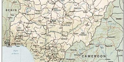
Geographically, Nigeria is blessed with abundant natural resources, including oil, natural gas, and minerals. The Nigeria regional map illustrates the locations of these resources, which significantly contribute to the country's economy. Understanding the distribution of these resources is essential for anyone interested in Nigeria's economic prospects and investment opportunities. Additionally, the map showcases Nigeria's major rivers, such as the Niger and Benue, which are vital for transportation and agriculture.
The practical uses of the Nigeria regional map are vast. It is utilized in urban planning, resource management, tourism, and education. For tourists, the map serves as a guide to explore Nigeria's cultural heritage, national parks, and historical sites. In education, it is a valuable resource for students and researchers who are studying the geography and history of Nigeria. Moreover, businesses can leverage the map to identify market opportunities and understand regional demographics.
In conclusion, the Nigeria regional map is not just a simple representation of political boundaries; it is a reflection of the country's rich cultural diversity, historical context, and geographical significance. Whether you are a student, a researcher, or a traveler, exploring this map can provide valuable insights into Nigeria's complex identity and its role in West Africa.
Understanding the Nigeria regional map is vital for appreciating the country's rich culture and diversity. We encourage you to explore further and discover the fascinating geography of Nigeria.
-
Nigeria is the most populous country in Africa, with over 200 million residents, making the understanding of its regions essential for demographic studies.
-
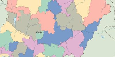
The country is divided into 36 states and one Federal Capital Territory, Abuja, which serves as the political center of Nigeria.
-
Nigeria has over 250 ethnic groups, with the three largest being the Hausa, Yoruba, and Igbo, each dominating different regions of the country.
-
The Niger River is the longest river in Nigeria, flowing approximately 4,180 kilometers, and is crucial for the country's agriculture and transportation.
-
The Jos Plateau, located in the North Central region, is known for its unique topography and cooler climate compared to the surrounding areas.
-
Nigeria has a coastline of about 853 kilometers along the Atlantic Ocean, contributing to its fishing industry and trade activities.
-
The North East region is home to the Chad Basin, which is a critical resource area that contains Lake Chad, a vital water source for millions.
-
Nigeria's diverse climatic zones range from tropical in the south to arid in the north, significantly influencing agriculture and lifestyle in different regions.
-
The country is rich in natural resources, with the Niger Delta region being one of the most prolific oil-producing areas in the world, contributing significantly to the economy.
-
The Map of Nigeria reflects historical trade routes that have existed for centuries, which have influenced cultural exchanges and regional interactions.