Explore the Delta Nigeria Map: Discover the Heart of Nigeria
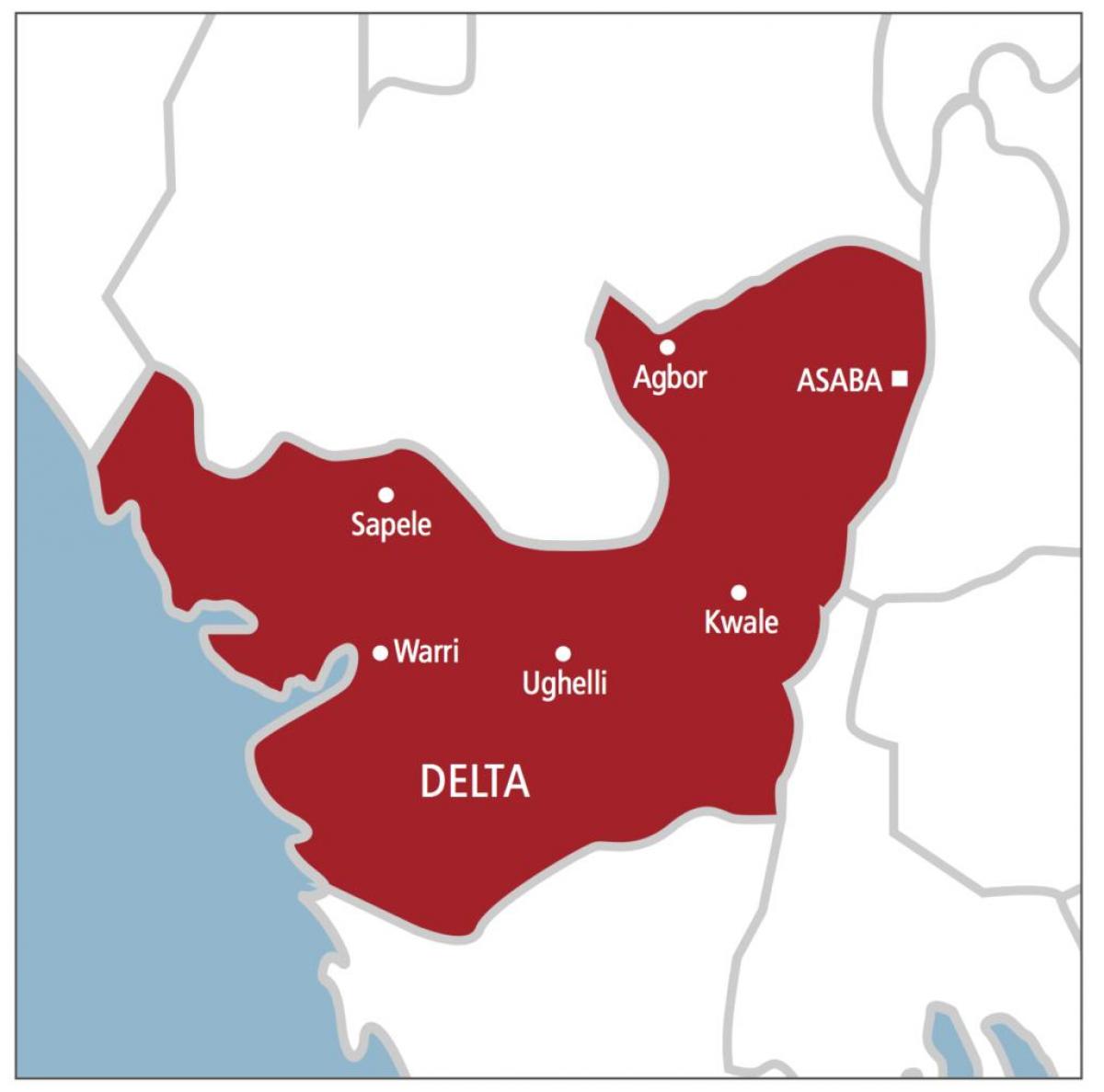
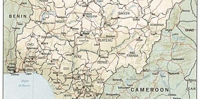
The Delta Nigeria map presents a detailed representation of one of the most vibrant and significant regions in Nigeria. Located in the southern part of the country, Delta State is rich in natural resources, diverse cultures, and sprawling landscapes. The map showcases various towns, waterways, and major road networks, enabling both locals and visitors to navigate this essential area of Nigeria with ease. Understanding the geography of Delta State is crucial for anyone looking to explore its unique offerings, from the bustling city of Warri to the serene beaches of the coastal towns.
Historically, Delta State has been a melting pot of cultures and ethnicities, primarily inhabited by the Urhobo, Itsekiri, and Ijaw people. The Delta Nigeria map highlights these cultural hubs and the socio-economic activities that take place within them. The map also reflects the historical significance of the region, which has been a focal point for trade and commerce since ancient times. The rich heritage of the Delta people is evident in their festivals, art, and culinary traditions, which attract tourists and researchers alike.
Geographically, Delta State is characterized by its extensive river networks, including the famous Niger River, which plays a crucial role in the local economy. The Delta Nigeria map accurately depicts these waterways, which not only serve as vital transportation routes but also support fishing and agriculture, key components of the local economy. Additionally, the lush vegetation and mangrove forests are critical for biodiversity and provide habitats for numerous species. This geographic landscape makes the Delta region an ecological treasure trove that is essential for environmental studies and conservation efforts.
Practical uses of the Delta Nigeria map extend beyond tourism and culture. It is an essential tool for businesses and government agencies involved in planning and development. By understanding the layout of the region, stakeholders can make informed decisions regarding infrastructure projects, resource management, and community development initiatives. Maps like this are also vital for disaster management, helping to identify flood-prone areas and facilitate emergency response strategies.
In conclusion, the Delta Nigeria map is more than just a geographical tool; it is a gateway to understanding the rich history, diverse culture, and economic potential of Delta State. Whether you are a researcher, tourist, or local resident, this map serves as an invaluable resource for exploring the heart of Nigeria. By delving into the details presented in this map, one can appreciate the beauty and significance of this remarkable region.
Exploring the Delta Nigeria map reveals a wealth of information about one of Nigeria's most dynamic areas. Dive deeper into the geography and culture of Delta State and uncover its many treasures.
-
Delta State is one of Nigeria's 36 states and was created on August 27, 1991.
-
The state capital, Asaba, is situated on the western bank of the Niger River, directly across from Onitsha in Anambra State.
-
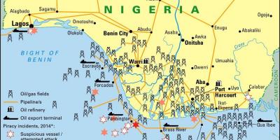
Delta State is home to the largest oil and gas reserves in the country, significantly contributing to Nigeria's economy.
-
The region has a rich cultural heritage, with traditional festivals such as the Ukwuani New Yam Festival and the Itsekiri Ojude Oba Festival attracting many visitors each year.
-
Delta State is known for its diverse ethnic groups, including the Urhobo, Itsekiri, Ijaw, and Ukwuani, each with its unique language and customs.
-
The state boasts several natural attractions, including the scenic Ologbo River and the pristine beaches of the coastal areas.
-
Delta's economy is primarily based on oil production, agriculture, and fishing, with agriculture providing employment to a significant portion of the population.
-
The region faces environmental challenges, including oil spills and erosion, which have prompted various conservation efforts.
-
Delta State is strategically positioned along the Benin River, which serves as an essential trade route for the movement of goods in the region.
-
The Delta Nigeria map illustrates not only the topography but also highlights key infrastructures such as the Warri Port, which plays a vital role in maritime trade.