Explore the Rich Geography of Nigeria: Understanding the Nigerian Map
The map of Nigeria is not just a simple representation of geographical boundaries; it is a detailed depiction that highlights the diverse landscapes, cultures, and resources of this vibrant West African nation. Nigeria, which is the most populous country in Africa, has a rich tapestry of ethnic groups, languages, and traditions, and its map serves as a gateway to understanding the complexities of its geography. From the arid regions in the north to the lush rainforests in the south, the Nigerian map illustrates the unique environmental zones that shape the lives of its inhabitants.
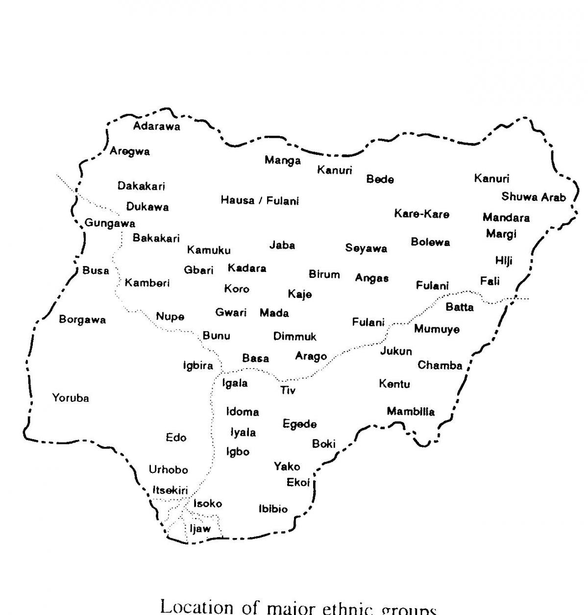
Historically, the Nigerian map has evolved significantly due to colonial influences, internal conflicts, and the quest for national unity. Originally, the territory now known as Nigeria was made up of various kingdoms and ethnic groups, each with its distinct territories. The amalgamation of these regions into one nation in 1914 by British colonialists set the stage for a complex political landscape. Understanding the history behind the map is crucial for appreciating how Nigeria's diverse cultural and ethnic identities have been influenced by its geographical divisions.
Geographically, Nigeria is bordered by Benin, Niger, Chad, and Cameroon, giving it a strategic position in West Africa. The country is characterized by various geographical features, including the Niger River, which is one of the longest rivers in Africa, and the Jos Plateau, known for its unique topography. This diversity in geography not only influences local climates but also affects agricultural practices, economic activities, and settlement patterns. By examining the map, one can appreciate how these features contribute to Nigeria's natural resources, including oil, minerals, and arable land, which are vital for the national economy.
The practical uses of the Nigerian map extend beyond academic interest; it is essential for urban planning, transportation, and tourism. With a growing population and rapid urbanization in cities like Lagos and Abuja, accurate mapping becomes crucial for infrastructure development and resource management. Additionally, the map aids travelers and tourists in navigating Nigeria's vast landscapes, understanding regional differences, and discovering cultural landmarks. From the historic sites in Kano to the beaches of Lagos, the map showcases the many attractions that Nigeria has to offer.
The significance of the Nigerian map cannot be overstated; it is a powerful tool for education, governance, and economic development. As students, researchers, and policymakers engage with this map, they gain insights into Nigeria's geographical challenges and opportunities. Furthermore, as the global community becomes more interested in Nigeria's potential, understanding its geography through its map will play a crucial role in fostering international relations and investments.
In conclusion, the Nigerian map is a valuable resource that unlocks the rich geography and diverse cultures of the country. By exploring this map, you can gain a deeper understanding of Nigeria and its significance on the world stage.
-
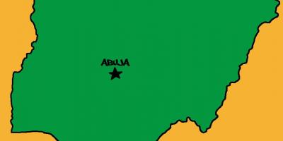
Nigeria is made up of 36 states and the Federal Capital Territory, where Abuja is located.
-
The Niger River, which flows through Nigeria, is the third longest river in Africa, spanning about 4,180 kilometers.
-
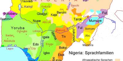
Nigeria is home to over 250 ethnic groups, with the three largest being the Hausa, Yoruba, and Igbo.
-
The country has over 500 languages spoken, making it one of the most linguistically diverse nations in the world.
-
Nigeria's coastline along the Atlantic Ocean stretches approximately 853 kilometers, facilitating significant trade and fishing.
-
The Jos Plateau in Nigeria is known for its cooler climate and is a major agricultural region, especially for crops like potatoes and corn.
-
Lake Chad, which borders Nigeria, is one of the largest lakes in Africa but has been shrinking due to climate change and human activity.
-
Nigeria is rich in natural resources, including oil, natural gas, coal, and tin, contributing significantly to its economy.
-
The country has a vibrant cultural heritage, with numerous festivals celebrated annually, each showcasing unique traditions of different ethnic groups.
-
Nigeria's population is projected to surpass 400 million by 2050, making it one of the most populous countries in the world.