Exploring the Industrial Map of Nigeria: Key Insights and Importance
The industrial map of Nigeria serves as a vital tool for understanding the country's economic landscape, highlighting the distribution of industrial activities across various regions. This map illustrates the locations of industries including oil and gas, manufacturing, agriculture, and mining, providing insight into the sectors driving Nigeria's economy. By identifying industrial hubs and key resources, the map enables stakeholders to make informed decisions regarding investments, infrastructure development, and policy formulation.
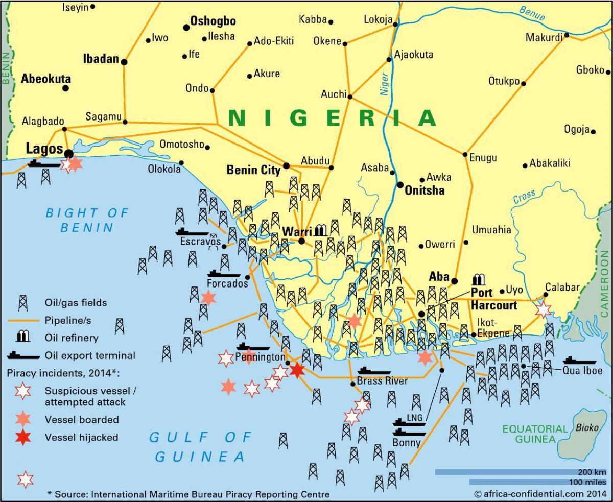
Historically, Nigeria has been a significant player in the African industrial scene, primarily due to its rich natural resources and diverse population. The industrial map reflects the evolution of sectors over the years, showcasing how colonial legacies and post-independence policies have influenced industrial development. For instance, the discovery of oil in the Niger Delta during the 1950s transformed the nation into a major oil producer, subsequently impacting economic policies and industrial focus. Understanding this historical context is crucial as it informs current industrial strategies and future growth opportunities.
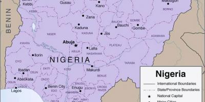
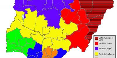
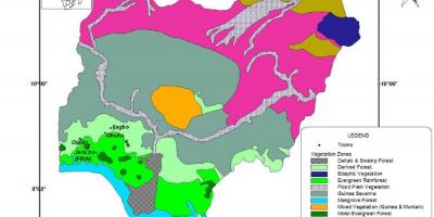
Geographically, Nigeria's industrial landscape is shaped by its diverse topography and climate variations. The northern regions are known for agriculture and textile manufacturing due to favorable farming conditions. In contrast, the southern regions, particularly Lagos and Port Harcourt, are industrial powerhouses characterized by oil refining and petrochemical industries. The industrial map highlights these geographic distinctions, making it easier for businesses to identify where to establish operations based on resource availability and market access. Additionally, the map facilitates regional planning, allowing governments to prioritize infrastructure improvements that will support industrial growth.
The practical uses of the industrial map of Nigeria extend beyond mere visualization. For investors, it serves as a guide for identifying emerging markets and sectors with the highest growth potential. Entrepreneurs can leverage the map to find suitable locations for setting up businesses, while policymakers can utilize it to formulate strategies that promote industrialization and economic diversification. Furthermore, educational institutions and researchers can use this map for studies related to economic geography, urbanization, and regional development.
In conclusion, the industrial map of Nigeria is more than just a representation of industrial activities; it is a comprehensive resource that encapsulates the economic, historical, and geographic factors influencing Nigeria's development. By understanding the dynamics depicted on this map, stakeholders can better navigate the complexities of Nigeria's industrial sectors, fostering sustainable growth and progress for the nation. As Nigeria continues to evolve, the industrial map will remain a crucial asset for anyone looking to explore the country's rich economic landscape.
The industrial map of Nigeria is an essential resource for understanding the economic dynamics of the country. It encourages further exploration of Nigeria's diverse geography and industrial opportunities.
-
Nigeria is the largest economy in Africa, primarily driven by its oil and gas sector, which accounts for about 90% of export revenues.
-
The Niger Delta region contains significant oil reserves, making it one of the most important industrial areas in Nigeria.
-
Nigeria has a diverse range of industries, including textiles, cement production, and food processing, showcasing its economic versatility.
-
The Lagos region is home to the largest concentration of industries in Nigeria, including manufacturing and financial services.
-
Nigeria's agricultural sector, which employs over 36% of the workforce, is a crucial part of the industrial map, particularly in the northern regions.
-
The country has several industrial parks, such as the Lekki Free Trade Zone, aimed at promoting foreign investment and economic growth.
-
Nigeria's manufacturing industry has seen a shift towards technology and innovation, with a growing number of startups contributing to industrial growth.
-
The country is rich in minerals like tin, limestone, and coal, which are essential for various industries and reflected in the industrial map.
-
Historically, the Nigerian government has implemented several policies aimed at promoting industrialization, including the National Industrial Revolution Plan.
-
The industrial map of Nigeria is regularly updated to reflect changes in infrastructure, investment, and industrial activities, ensuring its relevance for stakeholders.