Explore the Map of Africa Highlighting Nigeria's Unique Geography
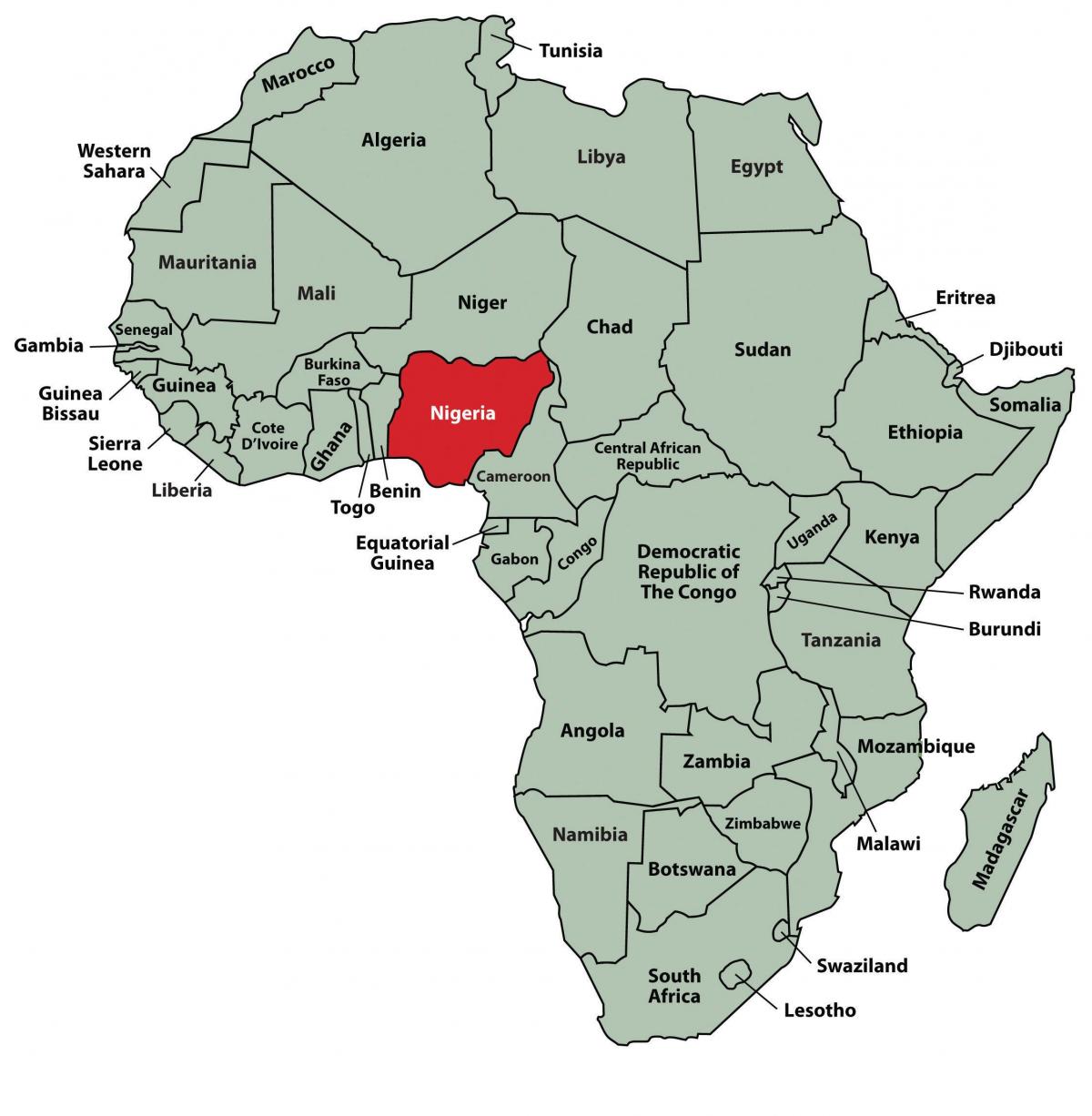
The map of Africa highlighting Nigeria serves as a vital tool for understanding the country's diverse geography and its position within the continent. Nigeria, located in West Africa, is the most populous nation in Africa and plays a crucial role in the region’s economy, culture, and politics. This map not only showcases Nigeria’s borders but also emphasizes major cities, geographical features, and neighboring countries, providing a clear visual representation of its significance in Africa.
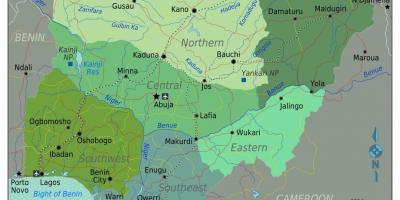
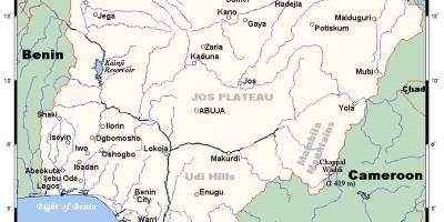
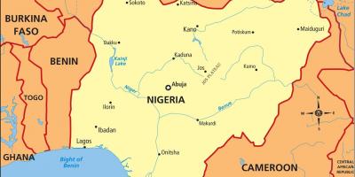
When examining the geographical layout, Nigeria shares its borders with Benin to the west, Niger to the north, Chad to the northeast, and Cameroon to the east. The map illustrates the country’s unique topography which includes the Niger River, the longest river in West Africa, flowing through Nigeria and serving as a critical waterway for trade and transportation. Additionally, the diverse landscapes, ranging from the coastal plains in the south to the mountainous regions in the north, are depicted, showing how geography influences the lifestyle and economy of the Nigerian people.
The historical context of Nigeria is also significant, as the country has undergone extensive changes over the centuries. The map serves as a reminder of Nigeria's colonial past, where the British divided various ethnic groups and regions into a single nation. Understanding these historical intricacies is essential for grasping current socio-political dynamics. The map highlights key historical landmarks, such as ancient cities and trade routes, which played a role in Nigeria’s development as a significant trade hub in West Africa.
Geographically, Nigeria is strategically located, making it a central player in African affairs. Its map indicates the proximity to the Gulf of Guinea, allowing for maritime trade and fishing industries to thrive. This geographical advantage has led to Nigeria becoming one of the largest economies in Africa, driven by sectors such as oil production, agriculture, and telecommunications. The map also illustrates the country's rich natural resources, which are vital for both domestic use and international trade.
Practical uses of a map of Africa showing Nigeria extend beyond mere navigation. It is a critical educational tool for students, researchers, and professionals interested in geography, history, and cultural studies. This map can facilitate discussions on topics such as regional development, urban planning, and environmental issues affecting Nigeria today. Furthermore, it aids tourists in planning their trips, allowing them to explore Nigeria's diverse landscapes and vibrant cultures, from the bustling streets of Lagos to the serene hills of Jos.
In conclusion, the map of Africa highlighting Nigeria is not just a representation of borders and cities; it encapsulates the rich tapestry of the nation’s geographical, historical, and cultural significance. Understanding this map allows one to appreciate Nigeria's role in the broader African context, making it an indispensable resource for anyone interested in the continent's dynamics.
This map of Nigeria provides valuable insights into the nation's geography and history. Explore the diverse regions of Nigeria and uncover the stories hidden within its landscapes.
-
Nigeria is the most populous country in Africa, with over 200 million inhabitants, representing more than 250 ethnic groups.
-
The Niger River, which flows through Nigeria, is approximately 4,180 kilometers long, making it the third-longest river in Africa.
-
Nigeria has more than 100 languages spoken across its regions, with Hausa, Yoruba, and Igbo being the most widely spoken.
-
Lagos, Nigeria's largest city, is one of the fastest-growing cities in the world and serves as a major financial hub in Africa.
-
The country is rich in natural resources, being one of the largest oil producers in Africa, contributing significantly to its GDP.
-
Nigeria's geography includes the unique Jos Plateau, which is known for its cooler climate and rich agricultural land.
-
The country is home to various national parks, including Yankari National Park, which is famous for its hot springs and diverse wildlife.
-
Nigeria has a coastline of about 853 kilometers along the Gulf of Guinea, providing access to maritime trade routes.
-
The historic city of Kano, located in northern Nigeria, was a central trading post in the trans-Saharan trade routes during the medieval period.
-
Nigeria's diverse ecosystems support a wide range of wildlife, including elephants, lions, and various bird species, making it a biodiversity hotspot.