Exploring the Hydrological Map of Nigeria: Importance and Insights
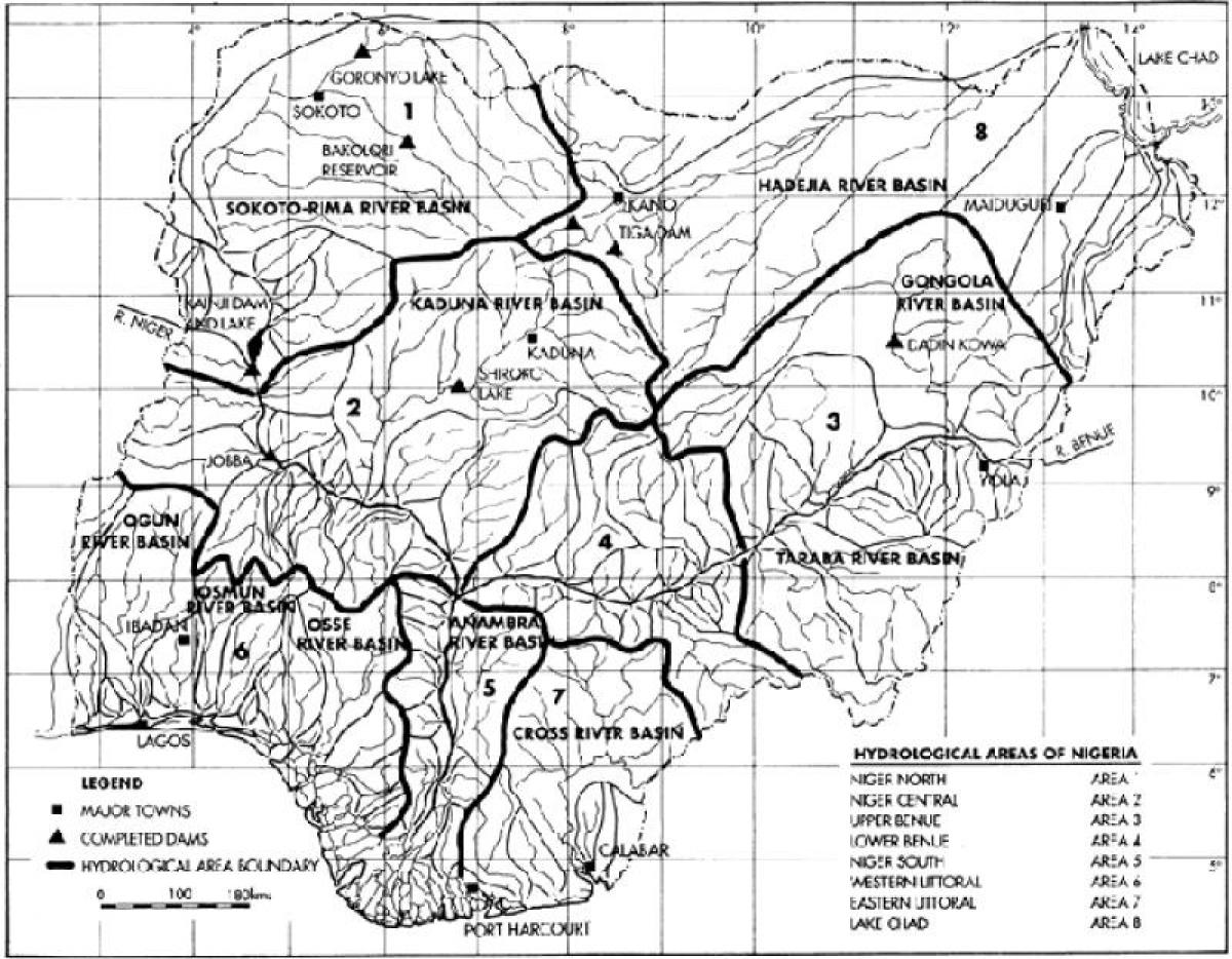
The hydrological map of Nigeria is a vital tool that illustrates the distribution and significance of water resources across the country. This map highlights key rivers, lakes, wetlands, and aquifers, providing a detailed overview of Nigeria's water bodies. Understanding the hydrology of Nigeria is crucial for various sectors, including agriculture, urban planning, and environmental management. Water resources are essential for sustaining life, supporting agriculture, and powering industries, making their mapping imperative for strategic planning and resource management.
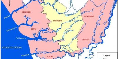
Historically, Nigeria's water systems have shaped human settlement and economic activities. The Niger River, one of Africa's longest rivers, flows through the country, providing water for millions of people. The hydrological map showcases the river's tributaries and the extensive network that connects various regions. Additionally, major lakes such as Lake Chad and various wetlands are essential for biodiversity, serving as habitats for numerous aquatic species. Understanding these water bodies through a hydrological map helps trace the historical significance of rivers and lakes in human civilization and economic development.
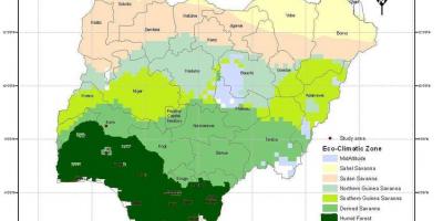
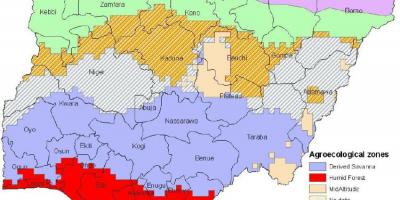
Geographically, Nigeria is endowed with diverse landscapes that influence its hydrology. From the coastal regions in the south to the arid northern zones, the map reflects how these varying terrains impact water availability and distribution. The hydrological map also identifies areas prone to flooding, drought, or water scarcity-issues that are increasingly relevant due to climate change. As urban areas expand, understanding the hydrological dynamics becomes critical for sustainable development and disaster management.
The practical uses of the hydrological map of Nigeria are numerous. For policymakers, it serves as a crucial resource for formulating water management policies and strategies. It aids in planning irrigation systems for agriculture, ensuring food security in a country where a significant portion of the population relies on farming. For environmentalists, the map provides insights into the health of ecosystems, guiding conservation efforts to protect wetlands and aquatic habitats. Furthermore, businesses in sectors such as tourism and fishing can leverage this information to make informed decisions.
In summary, the hydrological map of Nigeria is more than just a visual representation; it is an essential resource that supports various aspects of life in the country. As Nigeria continues to face challenges related to water management, climate change, and population growth, understanding its hydrological landscape becomes increasingly important. Embracing this knowledge will empower communities and stakeholders to effectively manage water resources for a sustainable future.
The hydrological map of Nigeria offers invaluable insights into the country's water resources and their significance for the environment and economy. By exploring this map, you can deepen your understanding of Nigeria's geography and its rich natural resources.
-
The Niger River, the longest river in Nigeria, spans over 4,180 kilometers and is crucial for the livelihoods of millions.
-
Lake Chad, once one of the largest lakes in Africa, has shrunk significantly due to climate change and over-extraction of water.
-
Nigeria has over 3,000 rivers, with the major ones being the Niger, Benue, and Kaduna rivers, each playing a vital role in the ecosystem.
-
Approximately 50 percent of Nigeria's land area is covered by wetlands, which are essential for biodiversity and flood control.
-
The Lagos Lagoon is a significant water body in Nigeria, providing habitat for diverse marine life and serving as a crucial fishing ground.
-
Nigeria's water resources are unevenly distributed, with the northern regions experiencing aridity while the southern regions are rich in water bodies.
-
The country has made strides in developing a national water policy to manage its water resources sustainably and equitably.
-
Flooding is a common issue in Nigeria, particularly during the rainy season, which has been exacerbated by deforestation and urbanization.
-
The hydrological cycle in Nigeria is influenced by the Atlantic Ocean, which brings moisture that supports the country's rainfall patterns.
-
The government has initiated various projects to restore and conserve the wetlands in Nigeria, emphasizing their importance for climate resilience.