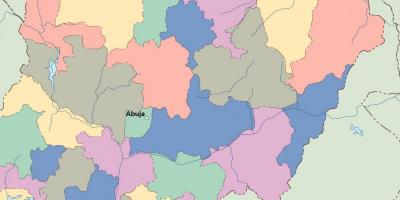
Explore the Map of Northern Nigerian States: Geography and Insights
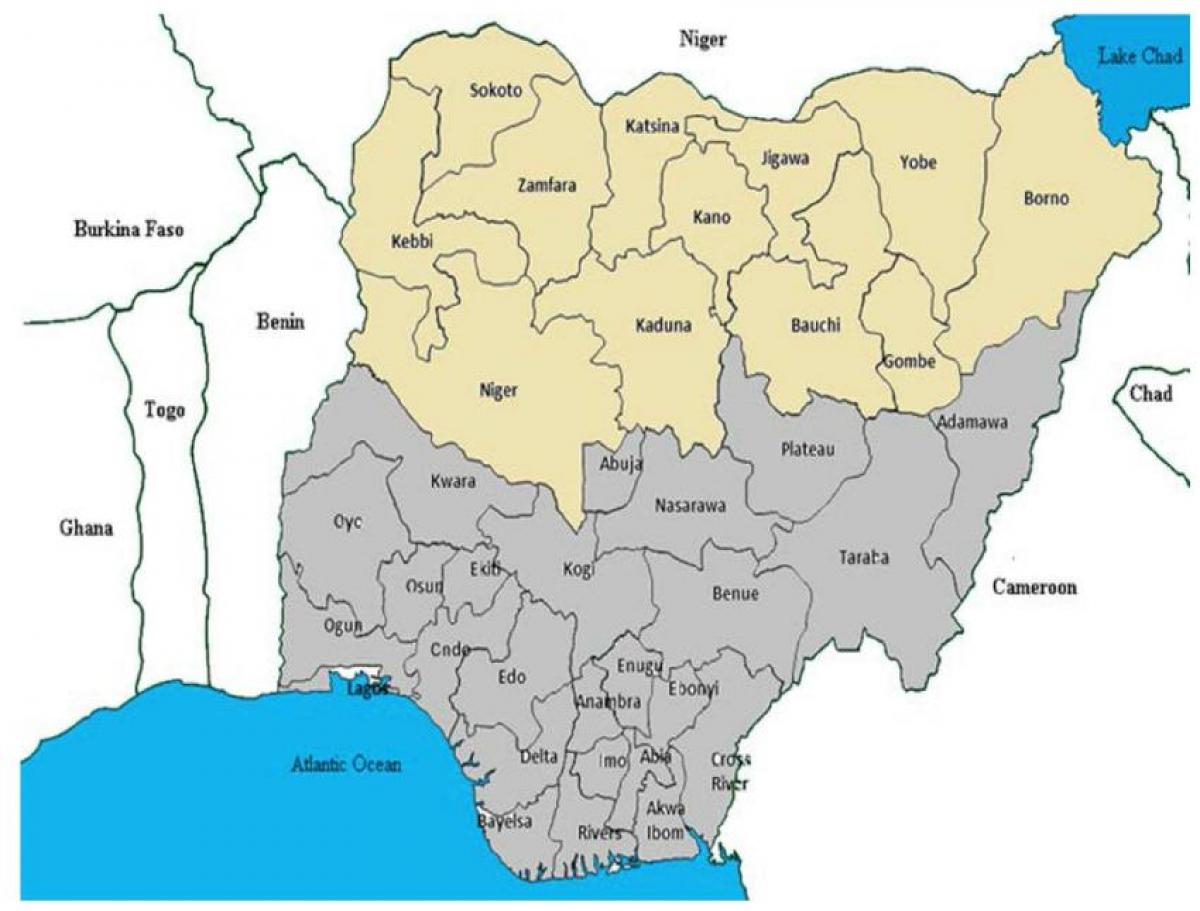
The map of northern Nigerian states is essential for understanding the diverse geography, culture, and history of this significant region in Nigeria. Northern Nigeria comprises 19 states, including Kano, Kaduna, and Sokoto, each with unique characteristics that contribute to the overall identity of the area. This map not only highlights the boundaries of these states but also serves as a window into the rich cultural tapestry and geographical features that define northern Nigeria. From the arid terrains of the North East to the lush landscapes of the North Central, the map showcases the varying climates and ecosystems found in this part of the country.
Understanding the geography of northern Nigeria is crucial for various reasons. Historically, this region has been a center for trade, agriculture, and cultural exchange. The map illustrates historic trade routes, such as those that linked the Sokoto Caliphate to other parts of West Africa. The significance of these routes cannot be understated; they facilitated not only economic activities but also the spread of religions and ideas. By examining the map, one can appreciate how geographical factors shaped historical events and influenced the development of societies in northern Nigeria.
Moreover, the map of northern Nigerian states is valuable for practical applications today. For travelers, understanding the geographical layout helps in planning routes for exploration. Northern Nigeria is home to several tourist attractions, including the ancient city of Kano, the scenic hills of Jos, and the majestic Argungu Festival. Each of these sites carries historical and cultural importance, and a detailed map assists visitors in navigating through these areas efficiently. Additionally, for researchers and policymakers, this map is a tool for analyzing demographic trends, resource distribution, and environmental challenges that the region faces.
The map also reflects the socio-political landscape of northern Nigeria. States like Borno and Yobe have been significantly affected by recent conflicts, including the Boko Haram insurgency. Understanding the geographical context of these states can shed light on the challenges faced by their populations and the efforts required for recovery and development. This highlights the importance of geographic awareness in addressing the socio-economic issues prevalent in northern Nigeria.
In conclusion, the map of northern Nigerian states is more than just a tool for navigation; it is a vital resource for understanding the historical, cultural, and geographical dynamics of the region. Whether you are a traveler, researcher, or someone interested in Nigeria's rich heritage, exploring this map opens up a world of insights that is both educational and engaging. By delving into the geography of northern Nigeria, one can appreciate the intricate connections between land, culture, and history.
Exploring the map of northern Nigerian states reveals the region's rich cultural and historical significance. Delve deeper into Nigeria's geography to uncover even more fascinating insights.
-
Northern Nigeria is home to the largest city in the region, Kano, which has a population of over 4 million people.
-
The Sokoto Caliphate, established in the early 19th century, was one of the largest empires in West Africa, influencing trade and culture across the region.
-
The North East region of Nigeria is known for its unique geological features, including the Gwoza Hills and the Mandara Mountains.
-
Jos, located in North Central Nigeria, is famous for its temperate climate and is often referred to as the 'Home of Peace'.
-
The Argungu Festival, held annually in Kebbi State, is one of Nigeria's oldest cultural festivals, celebrating the end of the fishing season.
-
Kano State is recognized for its historical textile industry, which was once a major trade hub in West Africa.
-
The region is primarily agricultural, with crops like millet, sorghum, and groundnuts being widely cultivated in northern Nigeria.
-
The North Central states, which include Benue and Niger, are known as the 'food basket' of Nigeria due to their rich agricultural production.
-
Borno State, located in the North East, is the largest state in Nigeria by land area, covering over 70,000 square kilometers.
-
The traditional Emirate system in northern Nigeria plays a significant role in local governance and cultural preservation, with many emirs still holding significant influence today.