Explore the Detailed Map of Nigeria with States and Cities
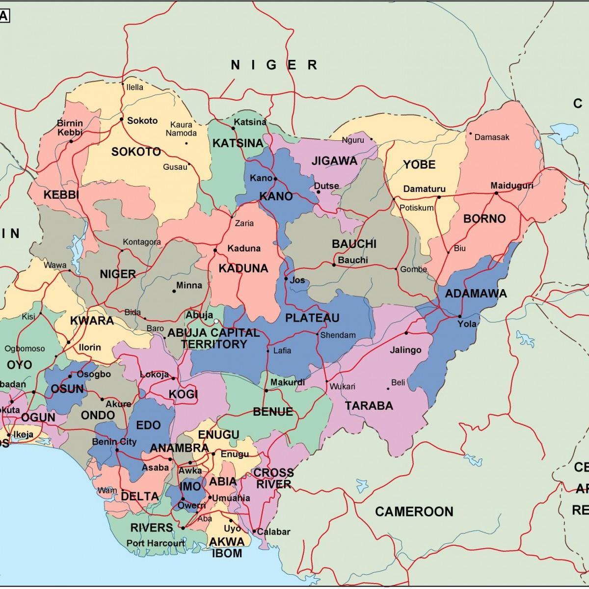
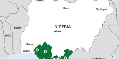
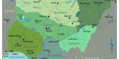
The map of Nigeria with states and cities serves as an essential tool for understanding the geographical and cultural landscape of this diverse nation. It provides a visual representation of Nigeria's 36 states and the Federal Capital Territory, Abuja. Each state is marked to showcase its unique location, size, and neighboring regions, making it easier for both locals and tourists to navigate the country. Additionally, the map highlights major cities, towns, and landmarks, offering insights into Nigeria's urban development and regional diversity.
Nigeria, located in West Africa, is known for its rich cultural heritage and diverse ethnic groups. The map is not just a navigational aid; it also reflects the historical context of Nigeria's formation. The country gained independence from British colonial rule in 1960, and its map has evolved over the years due to various administrative changes. Understanding the layout of Nigeria through its map provides a glimpse into the historical borders that have shaped the nation's identity.
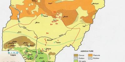
Geographically, Nigeria is characterized by a variety of landscapes, including savannahs, forests, and coastal regions. The map illustrates the significant geographical features such as the Niger River, which is one of the longest rivers in Africa, and the Jos Plateau, known for its unique topography. These features play a vital role in Nigeria's agriculture, tourism, and overall economy. Therefore, a map that effectively showcases these elements is invaluable for anyone looking to understand how geography influences life in Nigeria.
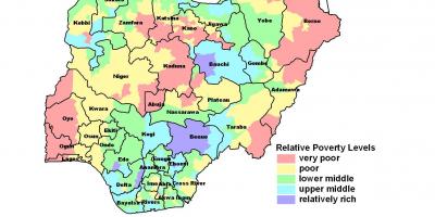
In practical terms, the map of Nigeria with states and cities is an essential resource for travelers, businesses, and researchers. For tourists, it helps in planning routes to popular destinations such as Lagos, Abuja, and Port Harcourt. Businesses can utilize the map for market analysis, identifying potential areas for expansion based on regional demographics. Researchers studying Nigerian history, culture, and geography can also benefit from the detailed information provided by the map, enabling them to make informed conclusions.
In conclusion, the map of Nigeria with states and cities is more than just a geographical representation; it encapsulates the essence of the nation. By understanding the layout and significance of various regions, one can appreciate the diversity and complexity of Nigeria. Whether you are a tourist planning a visit, a business looking for opportunities, or a researcher delving into Nigeria's past, this map is an indispensable guide to exploring the heart of Nigeria.
In summary, the map of Nigeria with states and cities is a crucial resource that enhances our understanding of this vibrant nation. We encourage you to explore further into Nigeria's geography and discover its many wonders.
-
Nigeria is divided into 36 states and one Federal Capital Territory, Abuja, which serves as the political center of the country.
-
The largest city in Nigeria is Lagos, known for its bustling economy and vibrant culture, and it is one of the fastest-growing cities in the world.
-
Nigeria is home to over 250 ethnic groups, with the three largest being the Hausa, Yoruba, and Igbo, each contributing to the country's rich cultural diversity.
-
The Niger River, which flows through Nigeria, is approximately 4,180 kilometers long, making it the third-longest river in Africa.
-
Nigeria has a coastline of about 853 kilometers along the Atlantic Ocean, providing vital access for trade and tourism.
-
The country is rich in natural resources, including oil and gas, which significantly influence its economy and political landscape.
-
Nigeria's geography ranges from arid northern regions to tropical rainforests in the south, showcasing diverse ecosystems and wildlife.
-
The city of Kano is one of the oldest cities in Nigeria, with a history that dates back over 1,000 years, reflecting the country's deep historical roots.
-
Nigeria's official language is English, a remnant of British colonial rule, which facilitates communication among its diverse population.
-
In 1976, Nigeria underwent a significant administrative reorganization, which led to the creation of many of its current states, reshaping its political landscape.