How to Draw a Sketch Map of Nigeria: A Comprehensive Guide
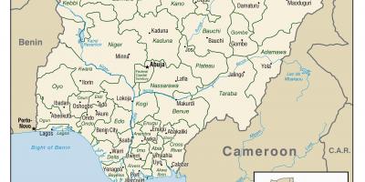
Creating a sketch map of Nigeria is not just about drawing lines and boundaries; it is an exercise that helps in understanding the country's diverse geography and rich history. Nigeria, located in West Africa, is the most populous country on the continent, with a mix of cultures, languages, and landscapes. A sketch map can visually represent this diversity, showcasing its 36 states, the Federal Capital Territory, and major geographical features such as rivers, mountains, and lakes. This map serves as a valuable educational tool for students, travelers, and anyone interested in Nigerian geography.
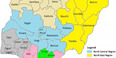
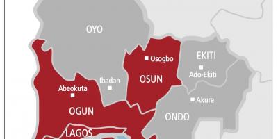
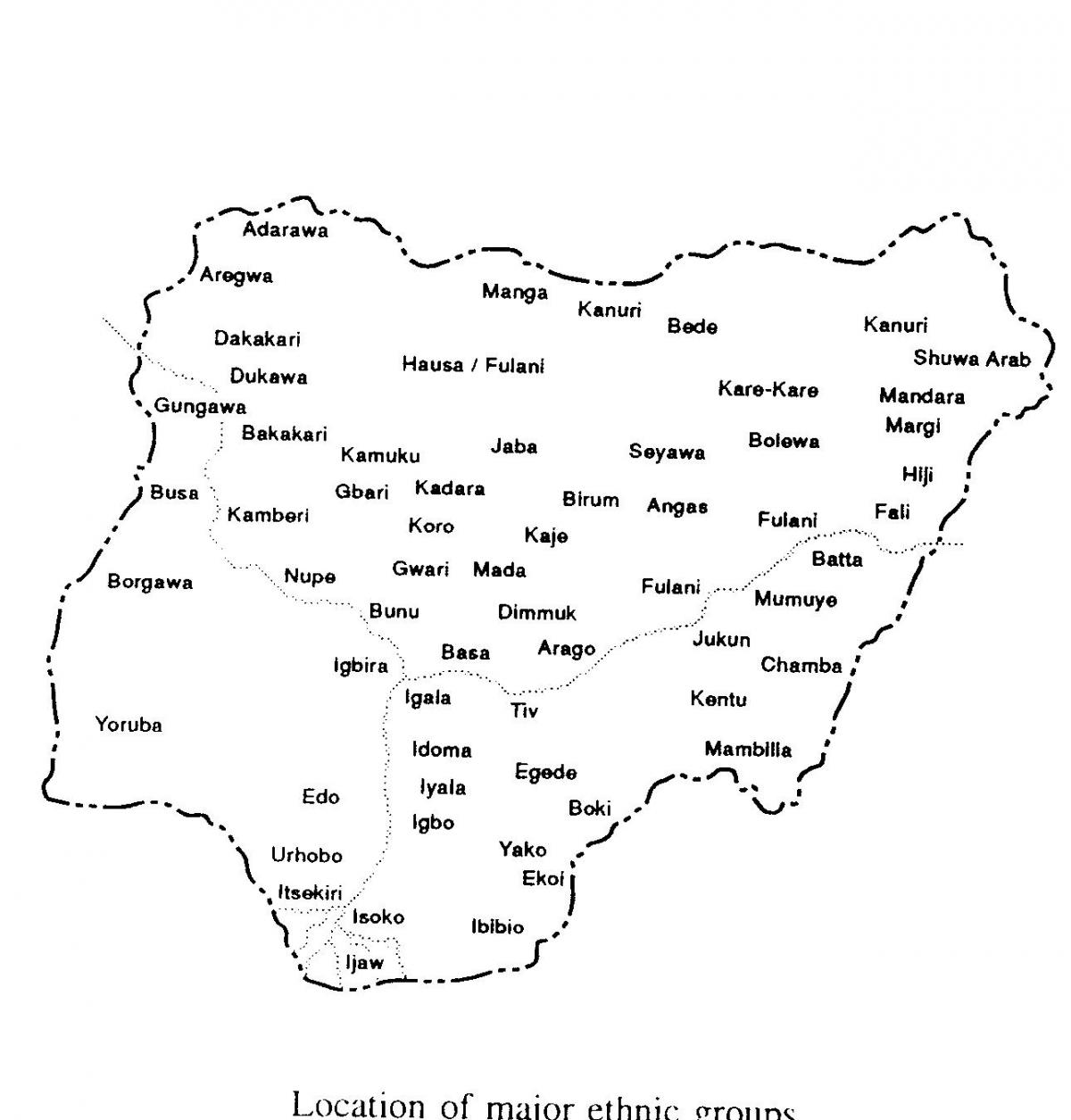
Historically, Nigeria's borders were defined during the colonial period, which has shaped its cultural and ethnic dynamics. The sketch map will often highlight the ethnic regions in Nigeria, including the Hausa-Fulani in the North, the Yoruba in the Southwest, and the Igbo in the Southeast. Understanding these divisions is crucial for appreciating the country's complex social fabric and the historical context of its conflicts and cooperations. A well-drawn sketch map also shows major cities like Lagos, Abuja, and Port Harcourt, providing a spatial understanding of where these urban centers are situated in relation to rural areas.
Geographically, Nigeria has a varied landscape that ranges from the coastal areas in the South, with a rich mangrove ecosystem, to the arid regions in the North. The sketch map should depict significant geographical features such as the Niger River, which is the longest river in Nigeria, and the Benue River, which merges with the Niger. The country's topography includes mountains like the Jos Plateau and the Mambilla Plateau, which are essential for understanding the climate and agriculture of various regions. This geographical diversity is a key reason why Nigeria is an agricultural powerhouse, producing crops like yams, cassava, and cocoa.
Practical uses of a sketch map of Nigeria extend beyond academic purposes. Tourists can use these maps to navigate through various attractions, including national parks, historical sites, and cultural landmarks. For businesses, understanding the geographical layout can aid in market research and logistics. Furthermore, policymakers can utilize such maps for urban planning, resource management, and disaster response strategies. A detailed sketch map can help visualize demographic data, economic zones, and infrastructure development, making it a critical resource for decision-making.
In conclusion, drawing a sketch map of Nigeria is a multifaceted task that encompasses geography, history, and practical applications. It provides an insightful look into the regions, cultures, and natural features that define Nigeria. By engaging in this mapping process, individuals can gain a deeper appreciation for the nation's uniqueness and complexities, while also enhancing their geographical literacy. Whether for educational purposes or personal exploration, a sketch map of Nigeria is an invaluable tool that opens the door to understanding this vibrant country.
A sketch map of Nigeria is a gateway to discovering its rich geography and cultural diversity. By exploring Nigeria's regions and features, you can foster a deeper appreciation for this fascinating nation.
-
Nigeria is the most populous country in Africa, with over 200 million people.
-
The Niger River, the longest river in Nigeria, stretches over 4,180 kilometers.
-
Nigeria is home to over 250 ethnic groups, making it one of the most diverse countries in the world.
-
The Federal Capital Territory, where Abuja is located, was created in 1976 to serve as the capital of Nigeria.
-
Lagos, Nigeria's largest city, is one of the fastest-growing urban areas globally, with a population of over 14 million.
-
The Nigerian economy is the largest in Africa, driven by oil, agriculture, and telecommunications.
-
Nigeria is rich in natural resources, including oil, natural gas, tin, and limestone.
-
The Jos Plateau, located in central Nigeria, is known for its picturesque landscapes and cooler climate.
-
Nigeria has several national parks, including Yankari National Park, which is famous for its hot springs and wildlife.
-
The country has three major regions: Northern Nigeria, Western Nigeria, and Eastern Nigeria, each with distinct cultural practices and languages.