Explore the Comprehensive Map of Nigeria: Geography and More
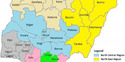
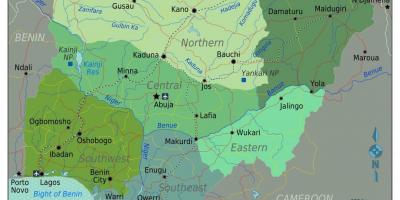
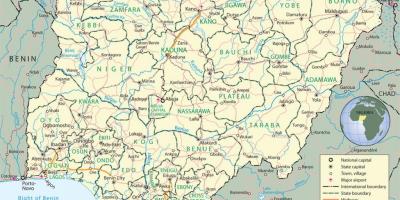
The Map of Nigeria serves as a vital tool for understanding the country’s geography, cultural diversity, and historical context. Nigeria, located in West Africa, is the most populous country on the continent, with over 200 million people. This map highlights the 36 states and the Federal Capital Territory, Abuja, showcasing the distinct geographical features ranging from coastal areas in the south to the arid regions in the north. Each state has its own unique characteristics, contributing to Nigeria's rich cultural tapestry.
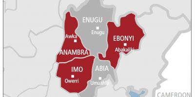
Understanding the Map of Nigeria is crucial for multiple reasons. First, it provides insights into the country's diverse ethnic groups, including over 250 different ethnicities. Each region has its own languages, traditions, and historical backgrounds. The map also indicates major cities such as Lagos, which is one of the largest cities in Africa, and Kano, a significant trade center in the north. By examining the map, one can appreciate the geographical distribution of these populations and their cultural implications.
Historically, the map of Nigeria reflects the colonial past and the subsequent amalgamation of various territories into one nation in 1914 by the British. This historical context is essential for understanding contemporary issues such as regional tensions, resource allocation, and ethnic conflicts. The map illustrates key historical landmarks, trade routes, and former colonial boundaries, making it a valuable resource for historians and students alike.
Geographically, Nigeria is characterized by diverse landscapes, including savannahs, rainforests, and mountain ranges. The Niger River, one of the longest rivers in Africa, flows through the country, serving as a crucial waterway for transport and agriculture. The map provides a detailed view of these natural features, helping environmentalists and geographers analyze ecological zones and biodiversity. Furthermore, the country's rich natural resources, including oil and gas, are significant for Nigeria’s economy and are marked on various maps, underlining their geographic importance.
Practical uses of the Map of Nigeria extend beyond academic purposes. Travelers and tour operators can use it to plan routes, identify tourist attractions, and understand regional cultures. Businesses can leverage the map to identify market opportunities, assess logistics, and strategize investments. Additionally, governmental and non-governmental organizations can utilize the map for social planning, disaster management, and resource distribution, ensuring that aid reaches the most affected areas during crises.
In summary, the Map of Nigeria is a comprehensive resource that provides valuable insights into the country’s geography, history, and cultural diversity. It is not just a tool for navigation; it is a window into the complex interplay of Nigeria’s past and present, showcasing the richness that makes Nigeria a unique nation. Whether you are a student, a traveler, or a business professional, exploring the Map of Nigeria can enhance your understanding of this vibrant country.
In conclusion, the Map of Nigeria offers invaluable insights into the nation's geography and cultural diversity. By exploring this map further, you can enrich your understanding of Nigeria's unique landscape and heritage.
-
Nigeria is home to over 250 ethnic groups, making it one of the most culturally diverse countries in the world.
-
Lagos, Nigeria's largest city, is one of the fastest-growing cities globally, with a population exceeding 14 million.
-
The Niger River, which flows through Nigeria, is the third-longest river in Africa, stretching about 4,180 kilometers.
-
Nigeria is the largest producer of oil in Africa and has the 10th largest reserves in the world, significantly impacting its economy and geography.
-
The country has over 500 languages spoken, with Hausa, Yoruba, and Igbo being the most prevalent.
-
Nigeria's geography includes diverse landscapes, from the sandy deserts in the north to tropical rainforests in the south.
-
The Federal Capital Territory, Abuja, was established in 1991, chosen for its central location to promote national unity.
-
The country covers an area of approximately 923,769 square kilometers, making it the 14th largest country in Africa.
-
Nigeria's population is projected to surpass 400 million by 2050, potentially becoming the third most populous country in the world.
-
The Aso Rock, a prominent 400-meter tall rock formation in Abuja, is a national landmark and serves as a backdrop to the Nigerian Presidential Complex.