Explore the Map of Africa with Nigeria Highlighted
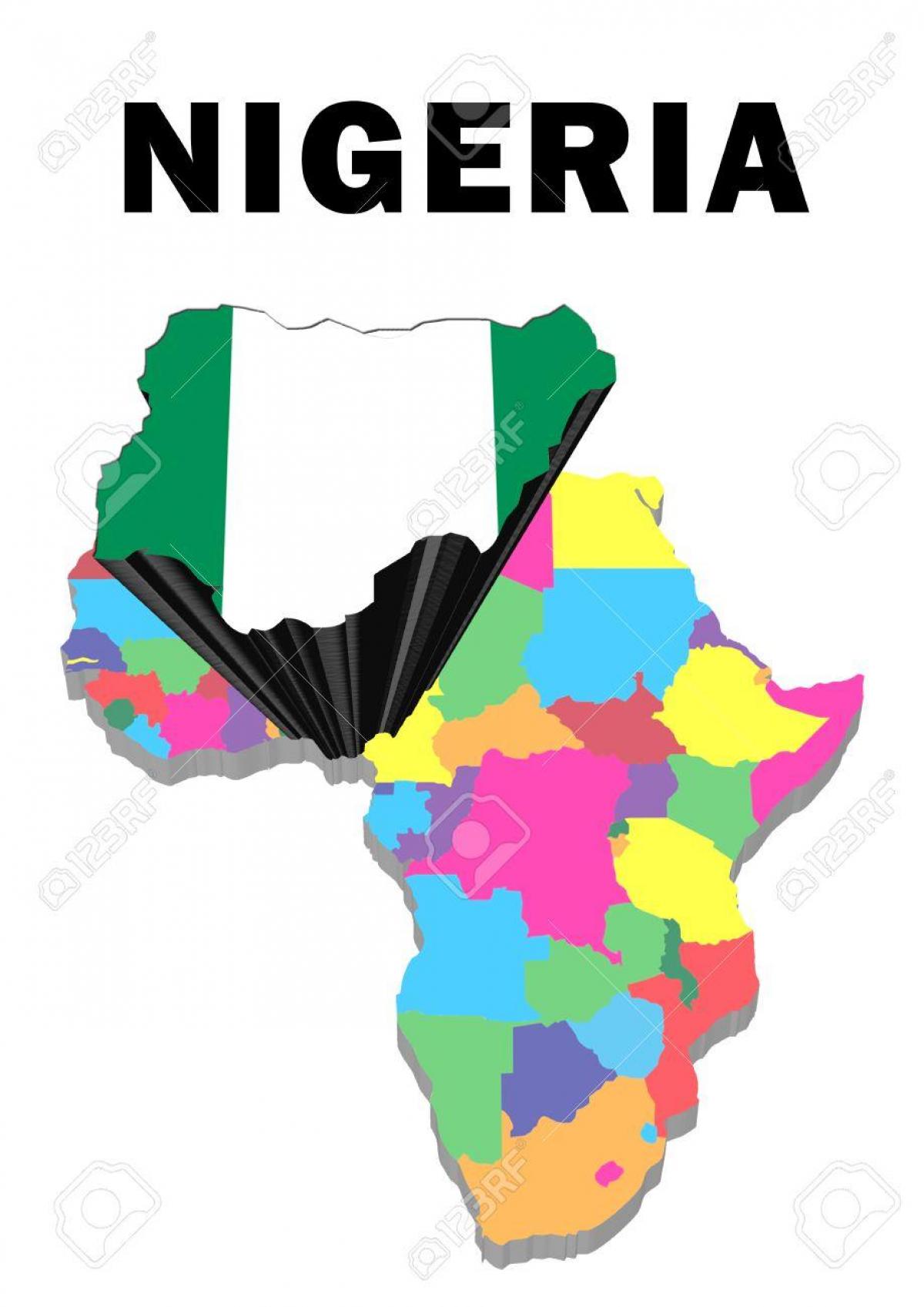
The map of Africa with Nigeria highlighted serves as a vital tool for understanding Nigeria's position on the continent. Nigeria is located in West Africa and is bordered by Benin to the west, Niger to the north, Chad to the northeast, and Cameroon to the east. This strategic location makes Nigeria a key player in both regional and international affairs. The highlighted map not only assists in visualizing Nigeria's geographical context but also emphasizes its role as the most populous country in Africa, with over 200 million inhabitants.
Understanding the layout of Nigeria on the African map is crucial for various reasons. Firstly, it showcases Nigeria's diverse ecosystems, ranging from the coastal areas along the Atlantic Ocean to the arid regions in the north. The geographical diversity is significant as it influences the country's agriculture, economy, and culture. The highlighted map allows viewers to appreciate how Nigeria's varied landscapes support different lifestyles and livelihoods, including agriculture in the fertile Niger River Valley and oil production in the Niger Delta region.
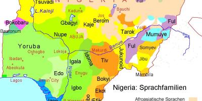
Historically, Nigeria has been a melting pot of cultures and ethnicities, which is reflected in its demographic composition. The highlighted map serves as a reminder of Nigeria's rich history, from ancient kingdoms to colonial rule and independence. Each region within Nigeria boasts its own unique heritage, which contributes to the country's overall identity. This historical significance is not only important for Nigerians but also for educators, researchers, and tourists who seek to understand the cultural fabric of the nation.
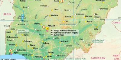
Geographically, Nigeria's location has implications for trade and commerce. The highlighted map illustrates Nigeria's access to the Atlantic Ocean, which facilitates international trade. Major ports such as Lagos and Port Harcourt are critical for the economy, allowing for the export of oil, agricultural products, and other goods. This economic activity enhances Nigeria's standing as a leader in the African economy, making the highlighted map a valuable resource for businesses and investors looking to engage with Nigerian markets.
In practical terms, the map of Africa with Nigeria highlighted is useful for various audiences. For students and educators, it offers a visual representation that enhances learning about African geography and Nigeria's significance. For travelers, it provides essential information about travel routes and destinations within Nigeria. Additionally, policymakers and NGOs can use the map to identify regions requiring intervention or support, ensuring that development efforts are effectively targeted.
In conclusion, the map of Africa with Nigeria highlighted is not just a geographical representation; it encapsulates the essence of Nigeria's role on the continent. It reflects the country's rich history, diverse ecosystems, and economic potential. Whether you are a student, a traveler, or a professional, this map is an invaluable resource for understanding Nigeria's place within Africa and the world.
Exploring the map of Africa with Nigeria highlighted opens up a world of geographical and cultural understanding. Dive deeper into Nigeria’s unique attributes and discover more about this vibrant nation.
-
Nigeria is the most populous country in Africa, with over 200 million people, making it a significant demographic force on the continent.
-
The Niger River, which flows through Nigeria, is the third longest river in Africa, spanning approximately 4,180 kilometers.
-
Nigeria is home to over 250 ethnic groups, with the three largest being the Hausa, Yoruba, and Igbo, each contributing to the nation's rich cultural diversity.
-
Lagos, Nigeria's largest city, is one of the fastest-growing cities in the world, with a population of over 14 million residents.
-
Nigeria is a major oil producer, ranking as the largest oil producer in Africa and the sixth-largest in the world, significantly impacting its economy.
-
The country has a coastline of about 853 kilometers along the Atlantic Ocean, providing vital access for trade and tourism.
-
Nigeria's geography includes the Sahel region in the north, which is characterized by semi-arid conditions, contrasting with the lush rainforests in the south.
-
The Aso Rock, a 400-meter tall rock formation, is a prominent geographical feature in Abuja, the capital city of Nigeria.
-
Nigeria's climate varies from tropical in the south to arid in the north, influencing agricultural practices and biodiversity across the regions.
-
The country has several national parks, such as Yankari National Park and Cross River National Park, which are crucial for wildlife conservation and tourism.