Exploring the Nigeria Map: Geography, History, and Significance
The Nigeria map is an essential tool for understanding the country's geography, cultural diversity, and historical context. Nigeria, located in West Africa, is the most populous nation on the continent, boasting over 200 million residents. The map highlights Nigeria's 36 states and the Federal Capital Territory, Abuja, providing a clear visual representation of its administrative divisions. Each region has its unique culture, language, and natural resources, making the Nigeria map a gateway to exploring the nation’s rich heritage.
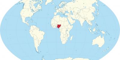
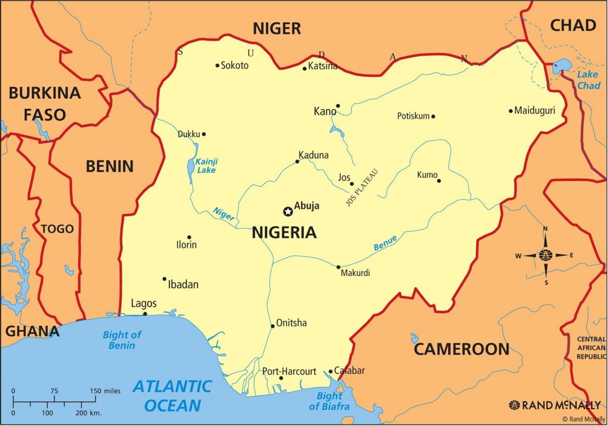
Understanding the geographical layout of Nigeria is crucial, as it influences various aspects of life, including commerce, transportation, and tourism. The country is bordered by Benin to the west, Niger to the north, Chad to the northeast, and Cameroon to the east. The coastline along the Atlantic Ocean to the south adds to Nigeria's strategic importance for trade and maritime activities. The Nigeria map displays diverse landscapes, from the coastal plains in the south, the rolling hills and plateaus in the central region, to the arid landscapes of the north, showcasing the country’s rich topographical variety.
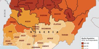
Historically, the Nigeria map reflects the colonial past and the subsequent evolution of its boundaries. The British colonial rule significantly shaped Nigeria's current borders, consolidating various ethnic groups under one administrative unit. This historical context is vital for understanding the socio-political dynamics in contemporary Nigeria. The mapping of ethnic groups and their distribution across the country is essential for analyzing regional conflicts, resource distribution, and governance issues. Thus, the Nigeria map serves not only as a geographical tool but also as a resource for scholars and policymakers.
In practical terms, the Nigeria map is invaluable for various sectors, including tourism, education, and urban planning. Tourists can use the map to navigate popular destinations such as Lagos, Abuja, and the scenic landscapes of Jos. Educational institutions often utilize maps to teach students about the country's geography and its cultural diversity. Urban planners rely on accurate maps to make informed decisions regarding infrastructure development and resource management. The Nigeria map plays a critical role in facilitating effective communication and understanding among different regions and communities.
Furthermore, with advancements in technology, digital maps of Nigeria have become widely accessible, offering interactive features that enhance user experience. These digital maps provide real-time data on traffic, weather, and even local businesses, making them indispensable for residents and visitors alike. The evolution from traditional paper maps to digital platforms reflects the increasing importance of geographical information systems (GIS) in modern society.
In summary, the Nigeria map is much more than a simple geographical representation; it encapsulates the country's rich history, diverse cultures, and significant geographical features. Understanding this map helps to appreciate Nigeria's complexity and its role in Africa and the world. Whether for educational purposes, travel planning, or academic research, the Nigeria map remains a vital resource for anyone interested in exploring this vibrant nation.
In conclusion, the Nigeria map is a crucial resource for understanding the country's geography and diverse cultures. By exploring its features, readers can gain deeper insights into the complex dynamics of Nigeria and its regions.
-
Nigeria is the most populous country in Africa, with over 200 million inhabitants, making it a significant demographic player on the continent.
-
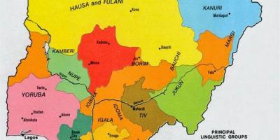
The country is home to more than 250 ethnic groups, with the three largest being the Hausa, Yoruba, and Igbo, each contributing to Nigeria's rich cultural tapestry.
-
Nigeria's Federal Capital Territory, Abuja, was officially designated as the capital in 1991, replacing Lagos due to its central location and growing population.
-
The Niger River, one of the longest rivers in Africa, flows through Nigeria and is vital for transportation, irrigation, and fishing for many communities.
-
Nigeria has a coastline that stretches over 800 kilometers along the Atlantic Ocean, which is crucial for trade and fishing industries.
-
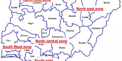
The country is divided into six geopolitical zones: North-East, North-West, North-Central, South-East, South-West, and South-South, each with distinct cultural identities.
-
Nigeria has significant natural resources, including oil and gas, which account for a large portion of the country's revenue and export earnings.
-
The Jos Plateau, located in the central region of Nigeria, is known for its cooler climate and beautiful landscapes, making it a popular tourist destination.
-
The country has over 400 languages spoken, with English being the official language, reflecting its diverse linguistic heritage.
-
Nigeria is home to several UNESCO World Heritage Sites, including the Sukur Cultural Landscape and the Aso Rock, highlighting its rich historical significance.